Introduction
I read a few excellent blog posts over the last number of years regarding how to calculate remoteness of buildings from each other.
The two that stand out for me are Topi Tjukanov’s Searching for Isolation with GIS and Simon Wrigley’s Finding the most remote buildings in Britain which offer excellent methodologies on how to find the most remote building in Flanders and Britain respectively . I have always been curious as to the most remote building* in Ireland (as measured from another building). I have been waiting (almost with bated breath) for Microsoft to release a building footprints dataset for Ireland, which they did earlier last year.
*Note – I thought long and hard and for this purpose, I am only interested in the most remote building from another building. For the purposes of this analysis, the building cannot be a ruin and must be weathertight.
Data Download and Processing
I downloaded the data for Ireland (using the provided scripts). As GeoJSONs aren’t an appropriate format to work with, I used GDAL’s ogrmerge.py command to merge all them into one, reproject to the Irish Transverse Mercator (EPSG: 2157) and output it as one GeoPackage file. I then uploaded the GeoPackage to a PostGIS database (using GDAL) in order to be better able to work with it.
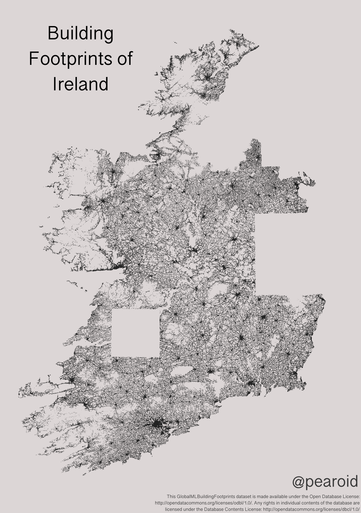
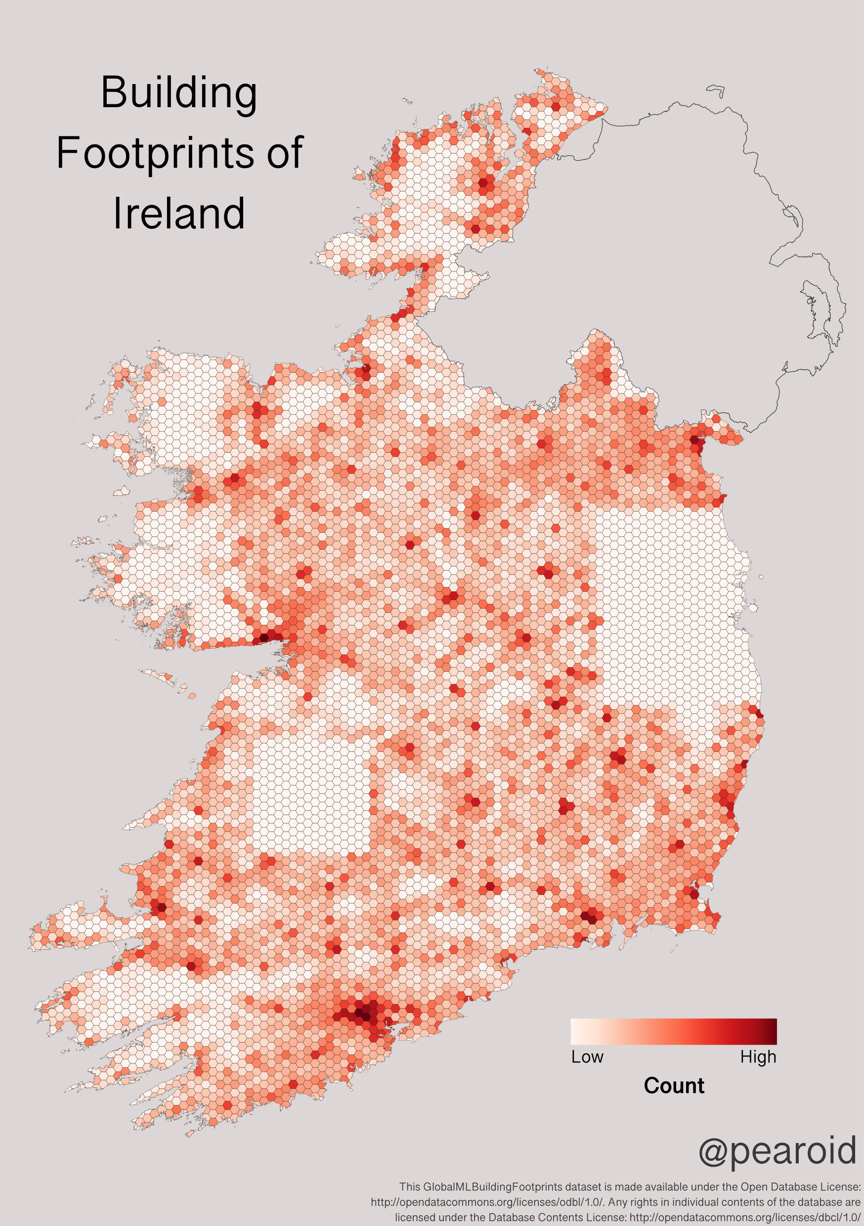
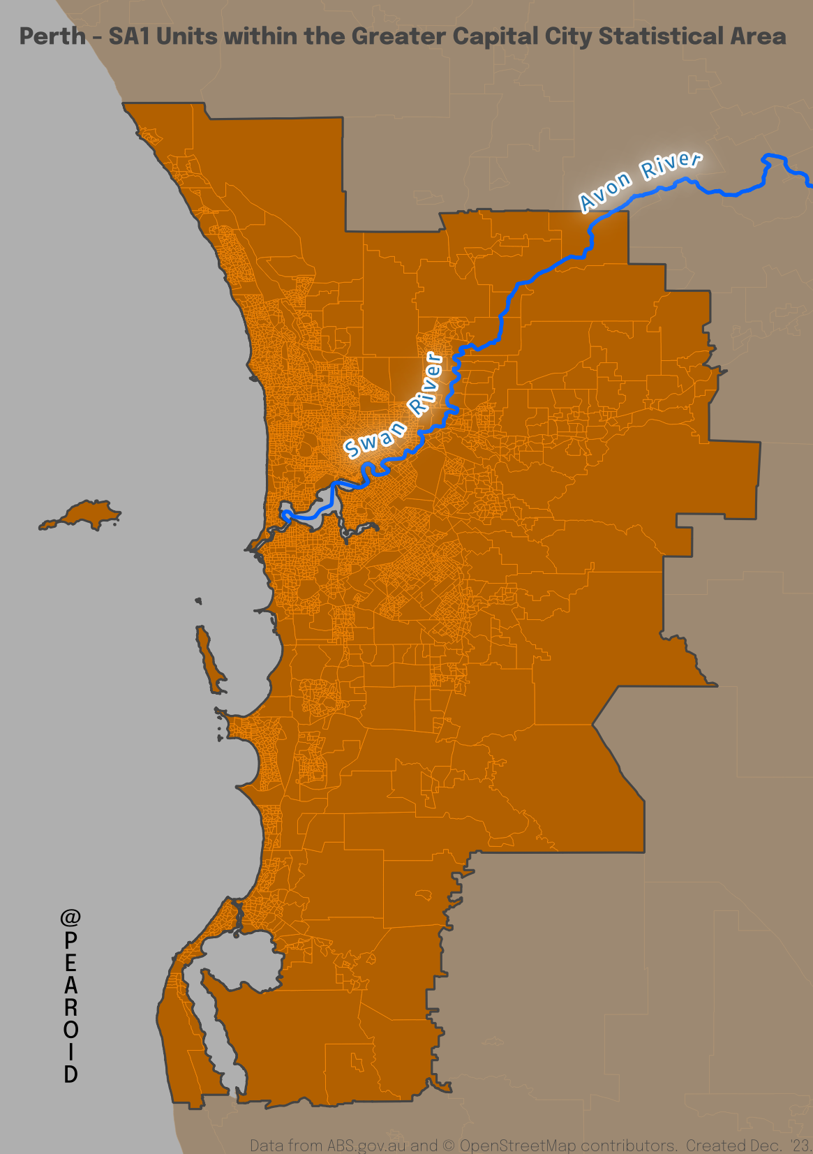
Below is an overview of the building footprints — it is obvious that there are two substantial areas missing around Dublin and Limerick. The dataset contains 2,270,112 buildings and the quality in places is dubious due to how it was created. I found a number of instances of silage pits and rocks etc. being mistaken for buildings. It’s a great effort by Microsoft to compile and, frankly, it’s the only dataset available as Tailte Éireann (the newly created public body with responsibility for mapping, property registration and valuation) has not released anything akin to the UK Ordnance Survey’s OpenMap Local Buildings product.

Building Footprints of Ireland from Microsoft
Missing Data
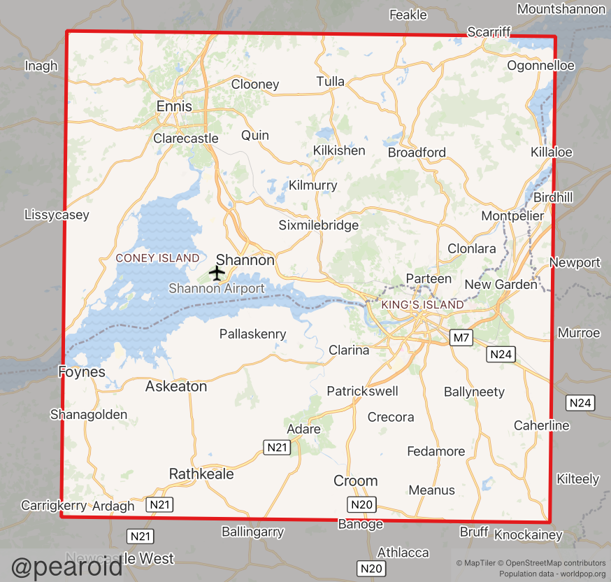
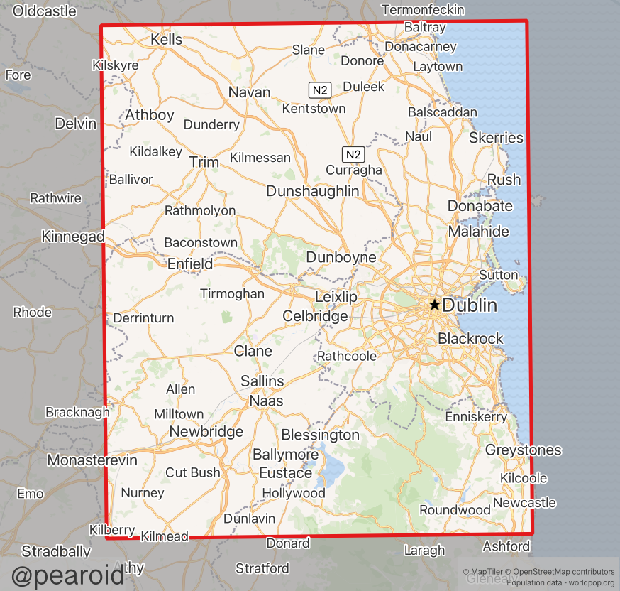
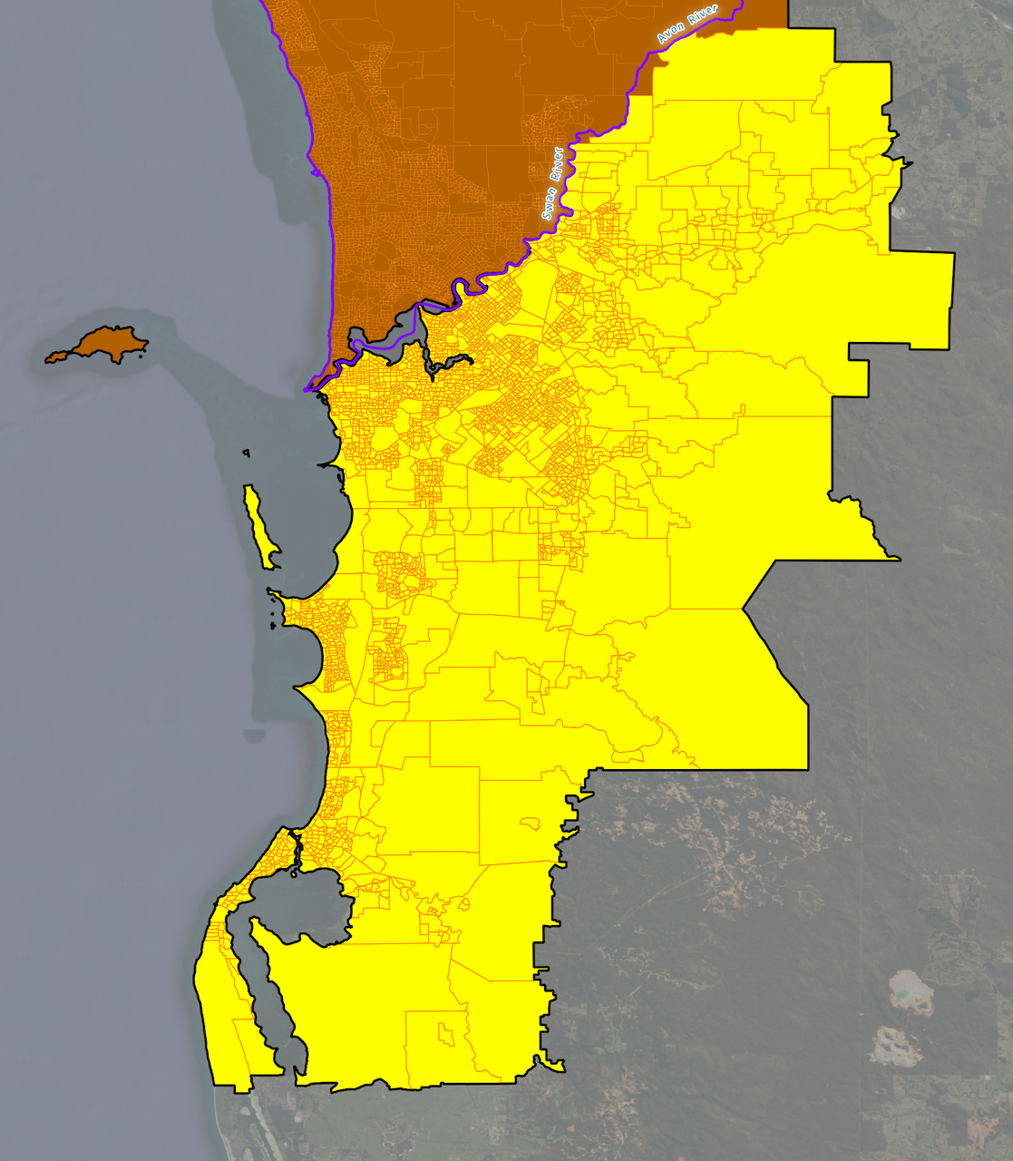
There are two large areas clearly missing from the above dataset, Greater Dublin and Greater Limerick. To get a sense of the problem, I downloaded population data from WorldPop, digitised the missing areas and used Zonal Statistics to calculate that the missing areas contain approximately 206,335 people in Greater Limerick and 2,117,635 for Greater Dublin (as shown below).
Missing Building Footprints – Greater Limerick
Missing Building Footprints – Greater Dublin
The two polygons shown above contain approximately 46% of the population of the country. Ordinarily, missing buildings over an area of the country that includes nearly half of its population would be a terrible outcome. The inverse held true for this analysis though; the more populated an area is, the more buildings it contains and the less likely it is to contain the most remote building in the country from another building. That’s not to say that the most remote building in the country isn’t located in these are, just that it’s unlikely.
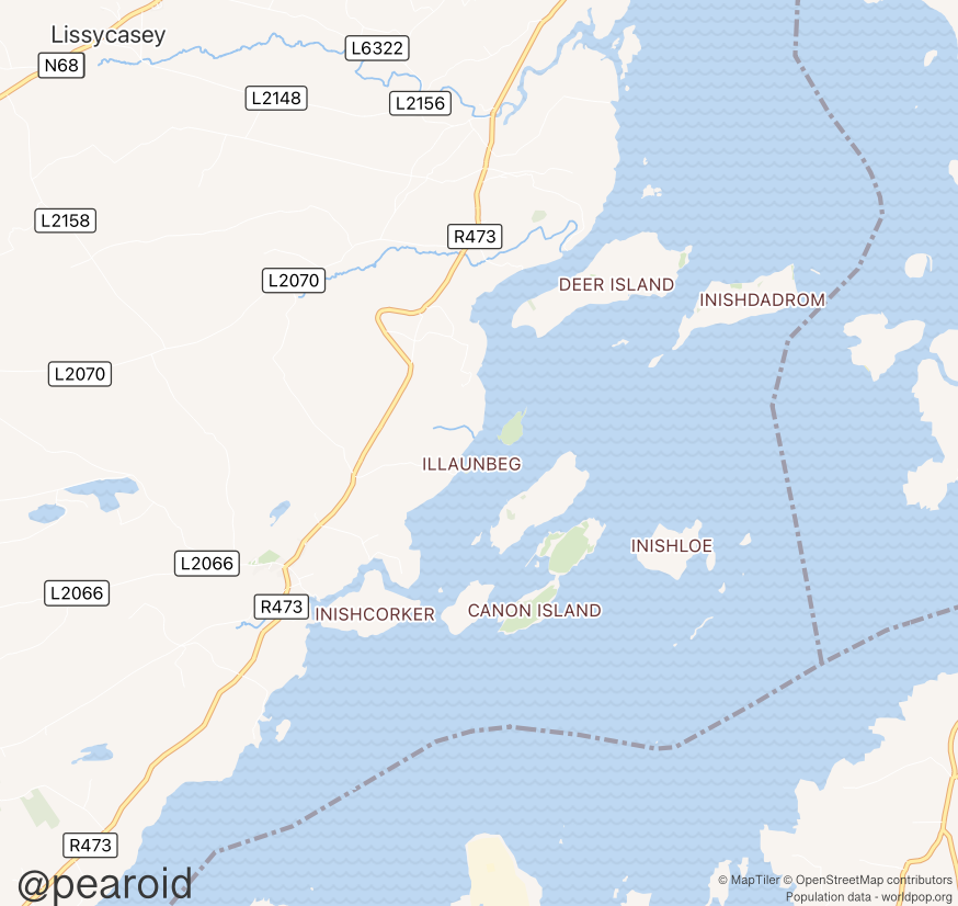
There are two obvious areas within both these polygons that could contain the most remote building, the islands in the Shannon Estuary and the Wicklow Mountains National Park. To give me some idea that the most remote building wouldn’t be in these areas, I manually (rather quickly) used the MapGenie basemap on Geohive to look for buildings. In the missing Limerick polygon, there were only two candidate areas that might contain the most remote building, one on Feenish and one on Inishtubbrid (neither of which was a greater distance to another building than the building identified at the end of this analysis). For this area I also looked at the Slieve Bearnagh range which didn’t produce any building greater than 500 metres from another building.
For the Wicklow Mountains, I examined the MapGenie basemap in detail but no immediate contenders were apparent.
Shannon Estuary Islands – Contenders for Most Remote Building
Analysis
I am indebted to Topi and Simon, and it’s Simon’s methodology I’m following here (almost to the letter). In order to reduce the computing power and time required, I did two things; I converted the building footprints in PostGIS to points (using ST_Centroid), and I used MMQGIS to create a 3km hex grid in QGIS that I imported into PostGIS using the below command. I then clipped the hex grid to the outline of Ireland and created spatial indexes for all tables.
 ogr2ogr \
-f "PostgreSQL" PG:"dbname='Ireland_Buildings' host=localhost port=xxxx user= 'postgres'" \
-nlt PROMOTE_TO_MULTI \
"Ireland_Admin_Outline.shp"
I adapted Simon’s very helpful building count SQL query and mapped it the buildings per hexagon (shown below).
Building Count – Ireland
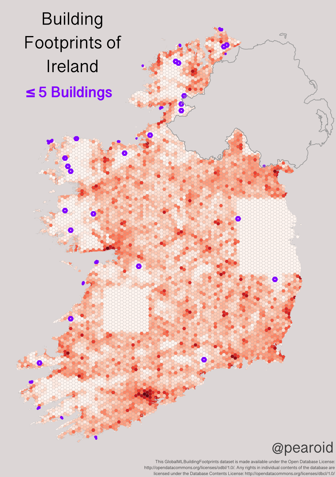
To reduce processing time, Simon counted the building footprints for each hexagon and only focused on the hexagons that had ≤1 building per grid cell. Because of the nature of the geography of both countries (essentially, the remoteness afforded by the Scottish Highlands), this exact approach wouldn’t work for Ireland. After some careful experimentation, I chose ≤5 as the number to use.
Less than or equal to 5 buildings per hexagon
The results accord well with areas of the country that one would consider remote as they don’t have the best quality agricultural land (such as West Connaught). It is important to state here that I ran several iterations of the above with various numbers of buildings and then followed Simon’s step of merging the resultant grid cells and buffering the cluster by 1km in order to find the most remote buildings. This took a considerable amount of time and I think I deleted about 50 contenders through this process.
Method: K-Nearest Neighbours
Simon did some excellent work creating Voronoi polygons to give a visual indication of the most remote building. If I’m being honest, I skipped this step and went straight to a nearest neighbour analysis. I’m not going to reinvent the wheel here so please have a read of Simon’s excellent methodology for the detailed SQL code.
I ran the nearest neighbour analysis (limiting the results to the top 10) and methodically went through all of them to see whether the first entry (being the most remote building listed was correct) and—🥁—it was.
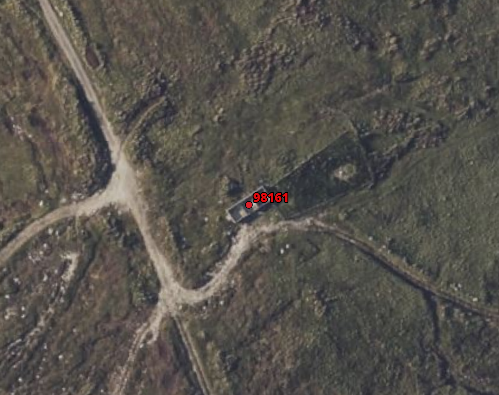
Bearing in mind that Ireland isn’t a particularly large country with vast remote areas etc. I wasn’t expecting the result to be a huge distance. I had discounted a lot of buildings along the way that were clearly not weathertight (such as the below) and, through that process, I knew the final result wouldn’t be numerically impressive.
False Positive – Cleary not weathertight
Most Remote Building
I think it’s crucial here to reiterate the main caveats to this answer, those are:
- The dataset was created using machine learning (limitations being a large number of false positives and potentially missing buildings); and
- There are areas around Dublin and Limerick missing that may contain a more remote building.
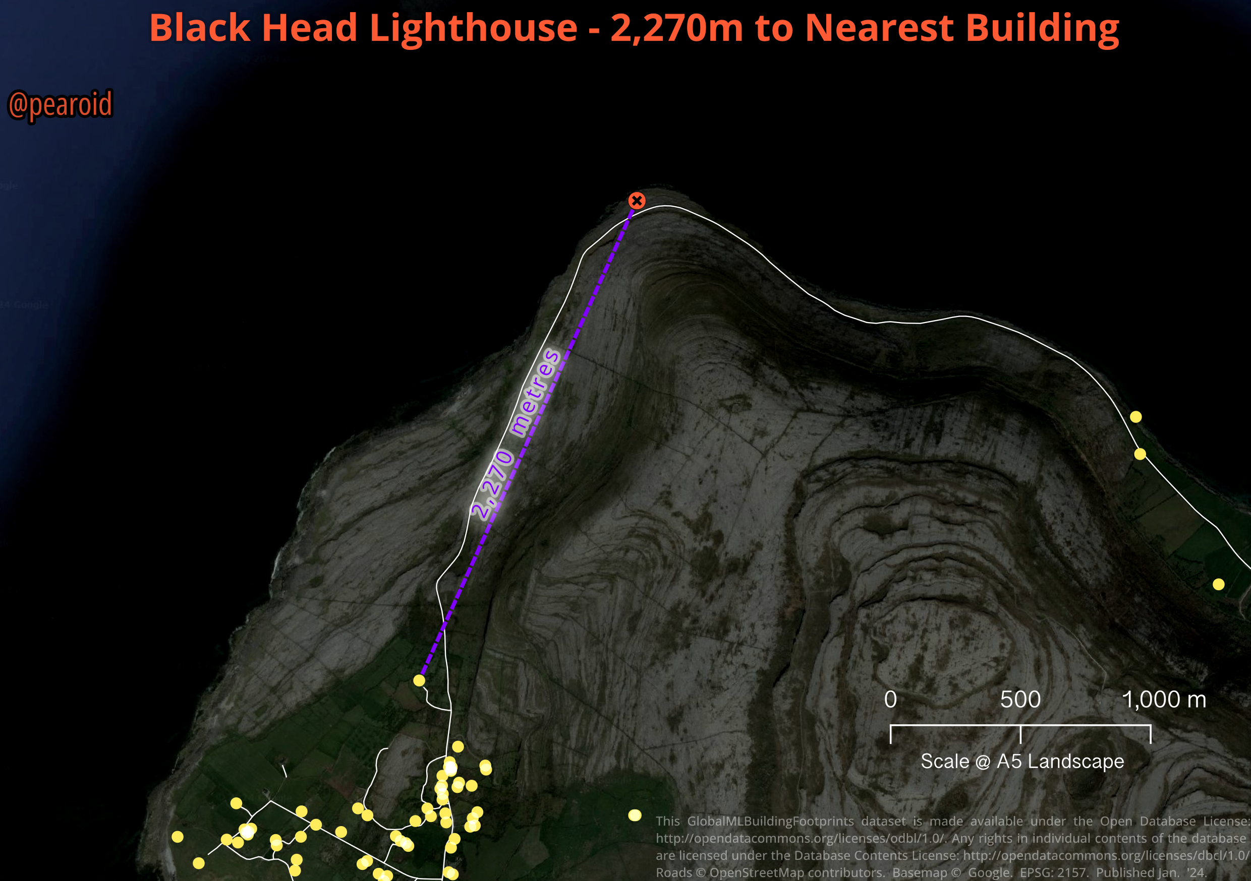
All that being said, the most remote building is:
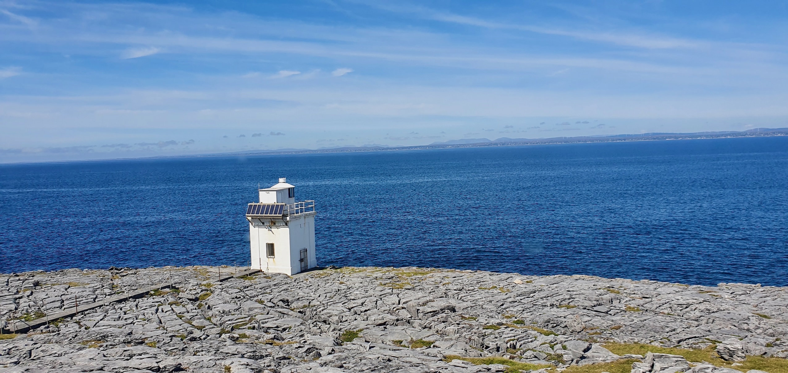
Blackhead Lighthouse, Burren Co. Clare - 2,270 metres to Nearest Building
Black Head Lighthouse, Co. Clare
It’s quite interesting that the lighthouse is in the Burren, Co. Clare, which is a karst landscape that is >500km² in area. I’ve inspected it on StreetView and it appears to meet the main criteria (i.e. weathertight). To ensure that there wasn’t any nasty surprises I again examined the MapGenie basemap on Geohive and, thankfully, there were no missing buildings in the vicinity. A very interesting structure to be the most remote (you can read more about it, including a detailed history, on the Commissioners of Irish Lights website).
Black Head Lighthouse by Yair Haklai is licence under a under the Creative Commons Attribution-Share Alike 4.0 International license.
CAVEAT
This was the most remote building based on the data available and the methodology used. I will rerun the analysis if and when the entire country becomes available. If you’ve gotten this far, thanks for reading.