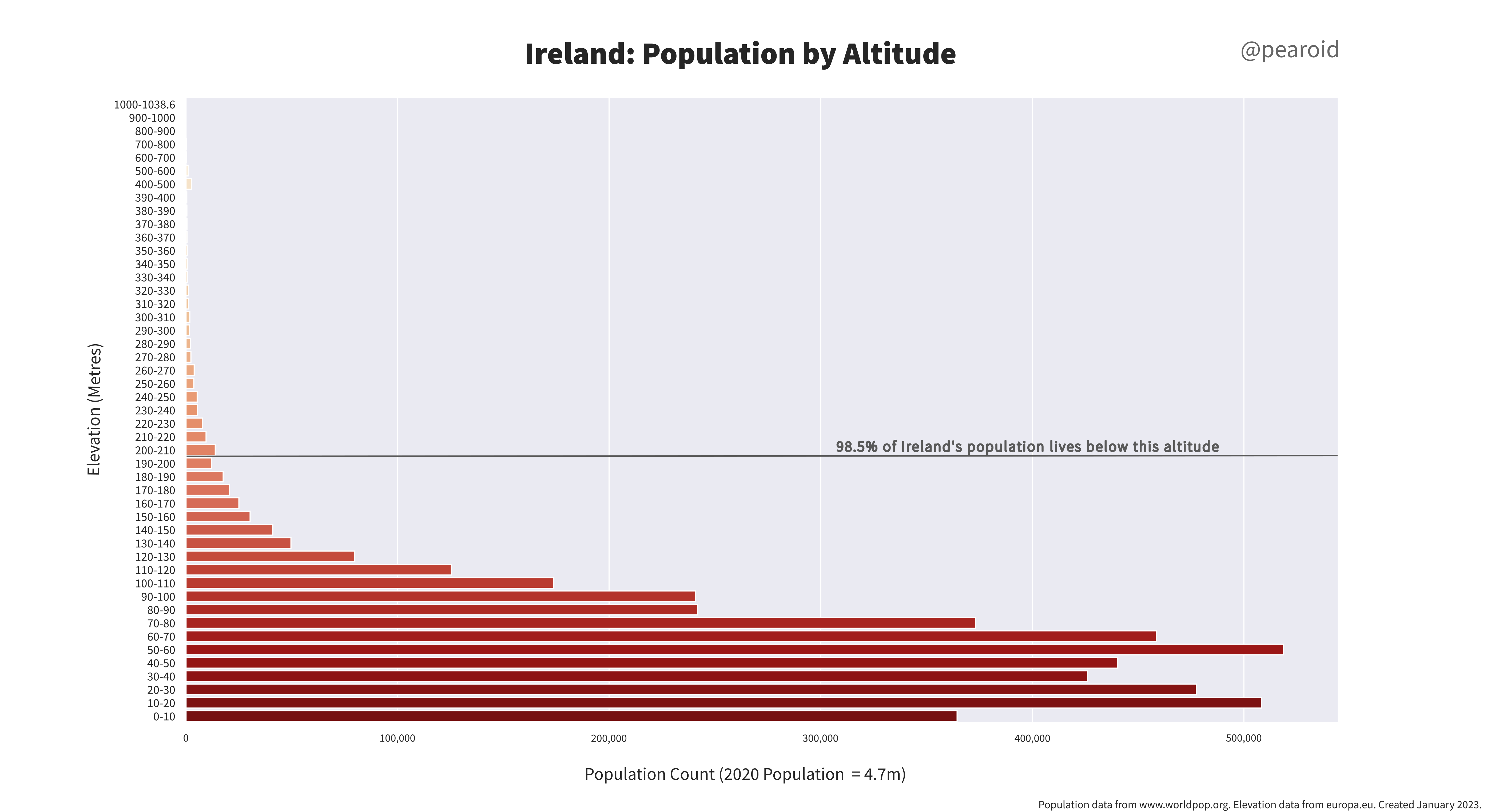
I read Alasdair Rae’s very interesting post where he created a graph of Great Britain’s population by altitude. Using WorldPop data and the EU DEM I used QGIS, Seaborn and Inkscape to create the following graph for Ireland. I must do a bit of digging to see whether the 400 – 500 metre slight bump can be explained by a discrete area…