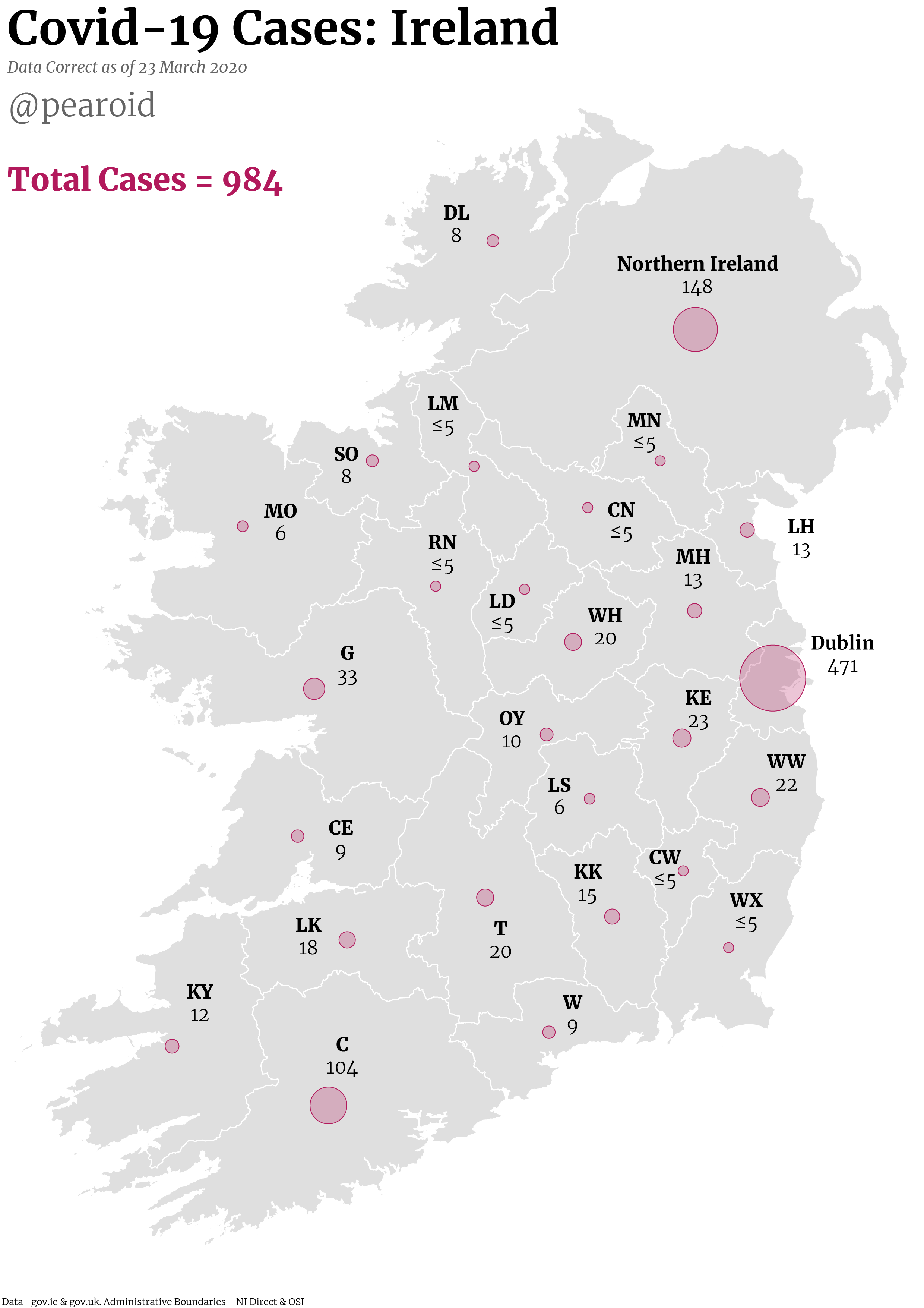
I’ve been creating daily maps of Covid-19 cases in Ireland using the official Government source. I think proportional symbols and proper labelling lead to the best outcome.
GIS Musings
I’ve been creating daily maps of Covid-19 cases in Ireland using the official Government source. I think proportional symbols and proper labelling lead to the best outcome.