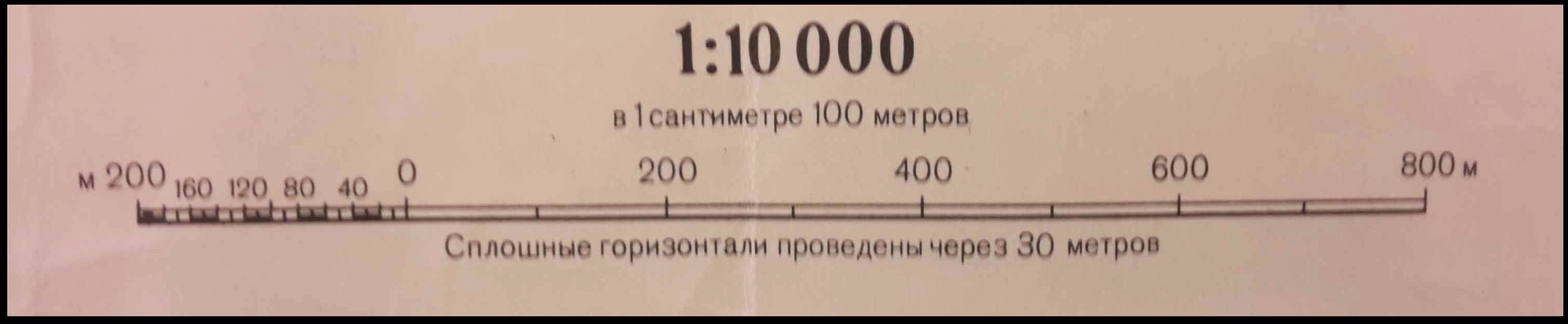
Recently, I’ve been reading about the maps that the Soviet’s produced of major cities in the United States, the UK and Ireland. Being Irish I was interested in what they had completed for Ireland. After some searching online I managed to get my hands on an original copy for Dublin. It was produced in 1980 at a scale of 1:10,000.
These maps were originally created to provide information should they ever decide to invade Ireland. They were created at the height of the cold war, 1980 was the year that the US boycotted the Olympics in Moscow and Tito died in Belgrade. With this in mind I started looking at the different locations in Dublin that I would be interested in should I have decided to invade.
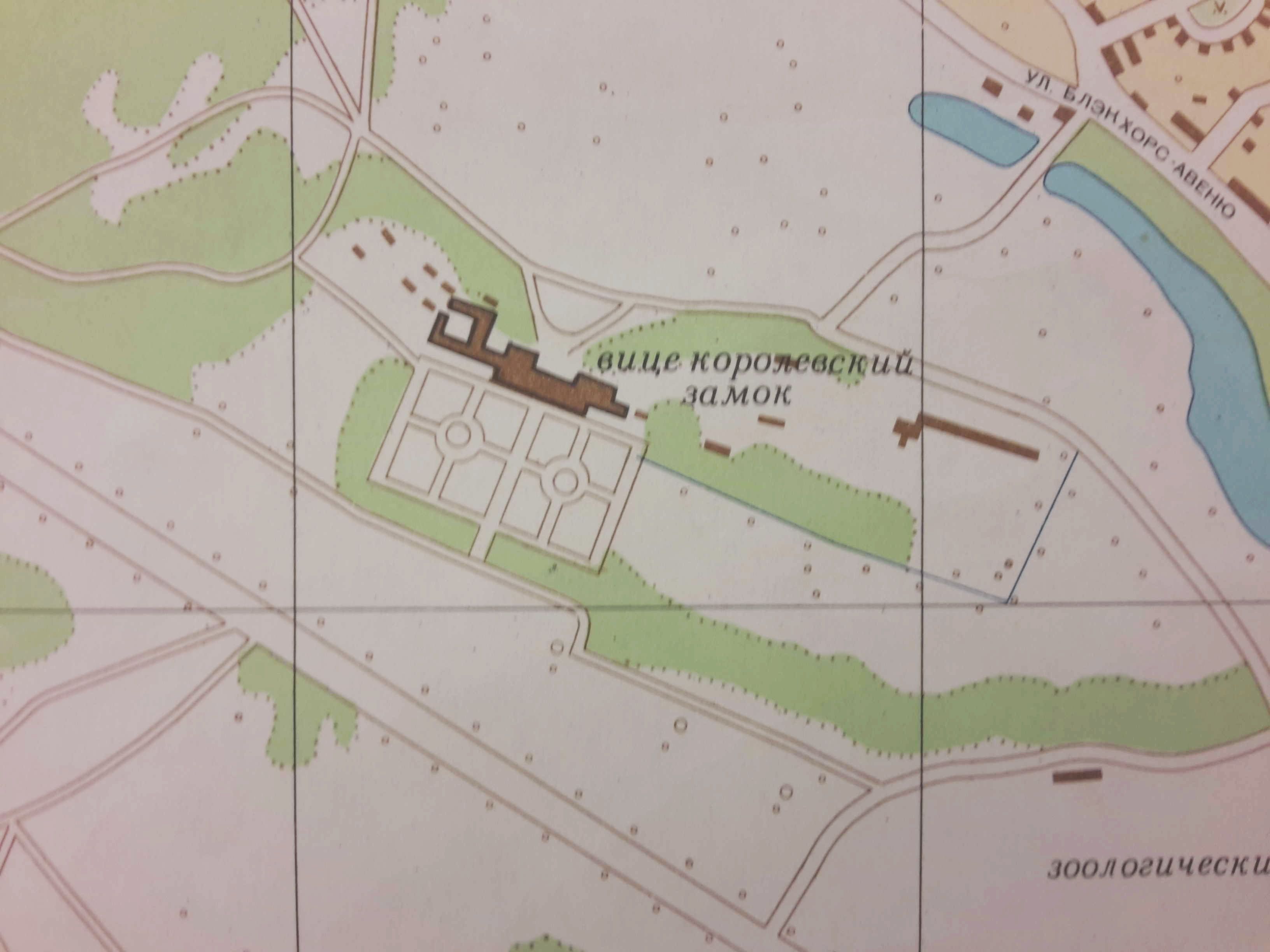
The map includes Áras an Uachtaráin (The official resident of the President of Ireland) as shown below. The layout of the building and the ground hasn’t changed much in the past 36 years.
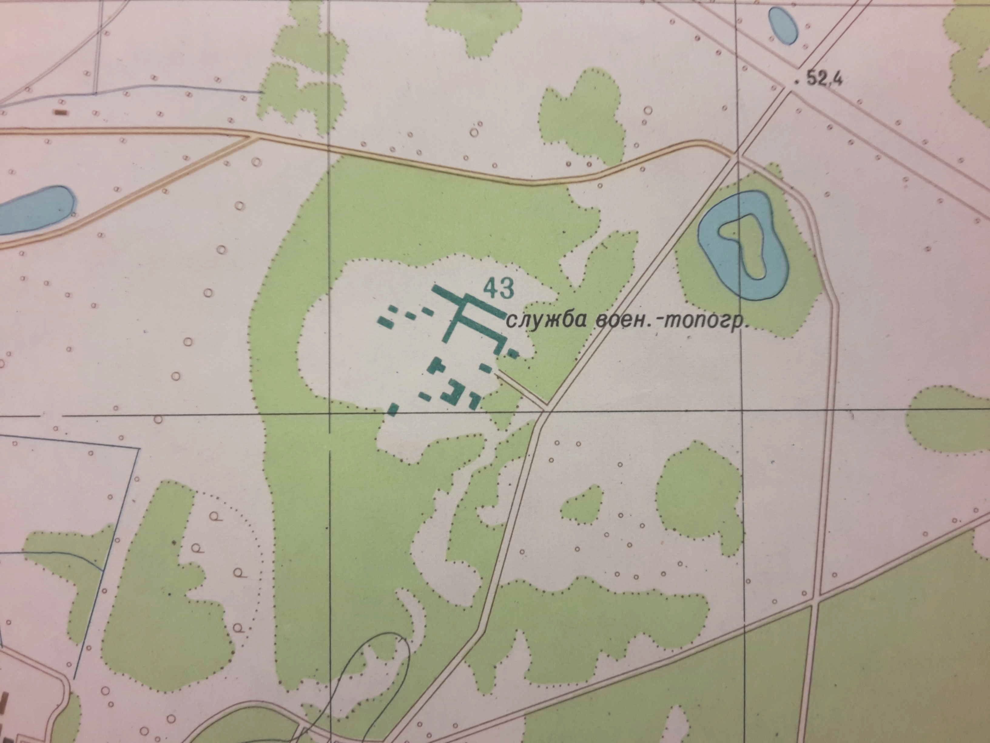
It would make sense that if you were making covert maps to be used by your military that you would know the location of the national mapping agency of a country you might invade. In this case they also shared my sentiments, the Ordnance Survey of Ireland (OSI) has been included in purple.
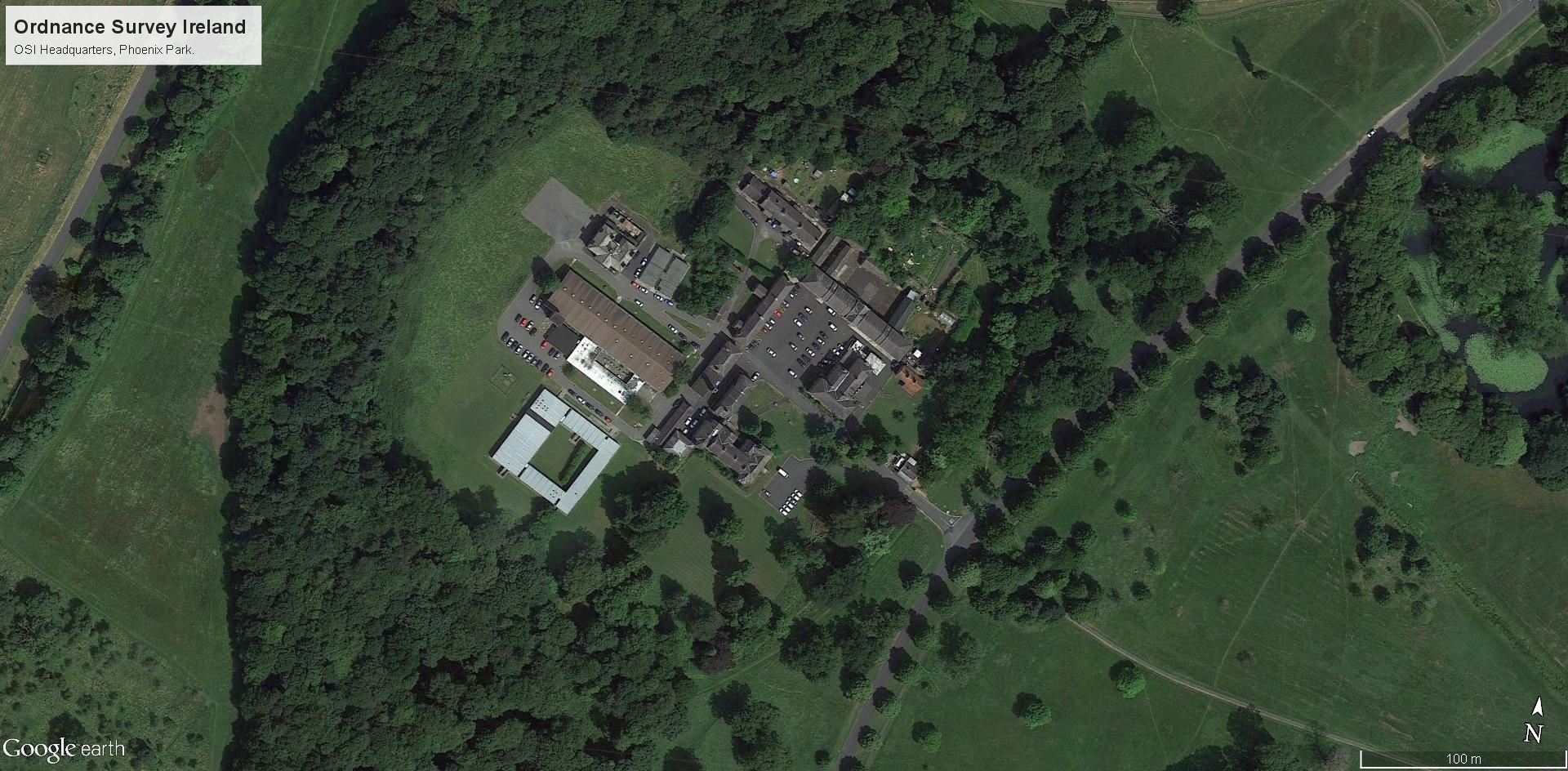
Searching for maps of the Phoenix Park from 1980 proved fruitless (at least for the time being, I will be in Dublin in March and I shall try again). I have to think that even with the buildings they have included that they left out a lot of outlying buildings. Below is the OSI as it looked on the 7th of December 2013.
The level of details for the rural areas is quite sparse even at 1:10,000 but for the city another building that they mapped was Mountjoy Prison. This prison was opened in 1850 and its design was based on Pentonville Prison.
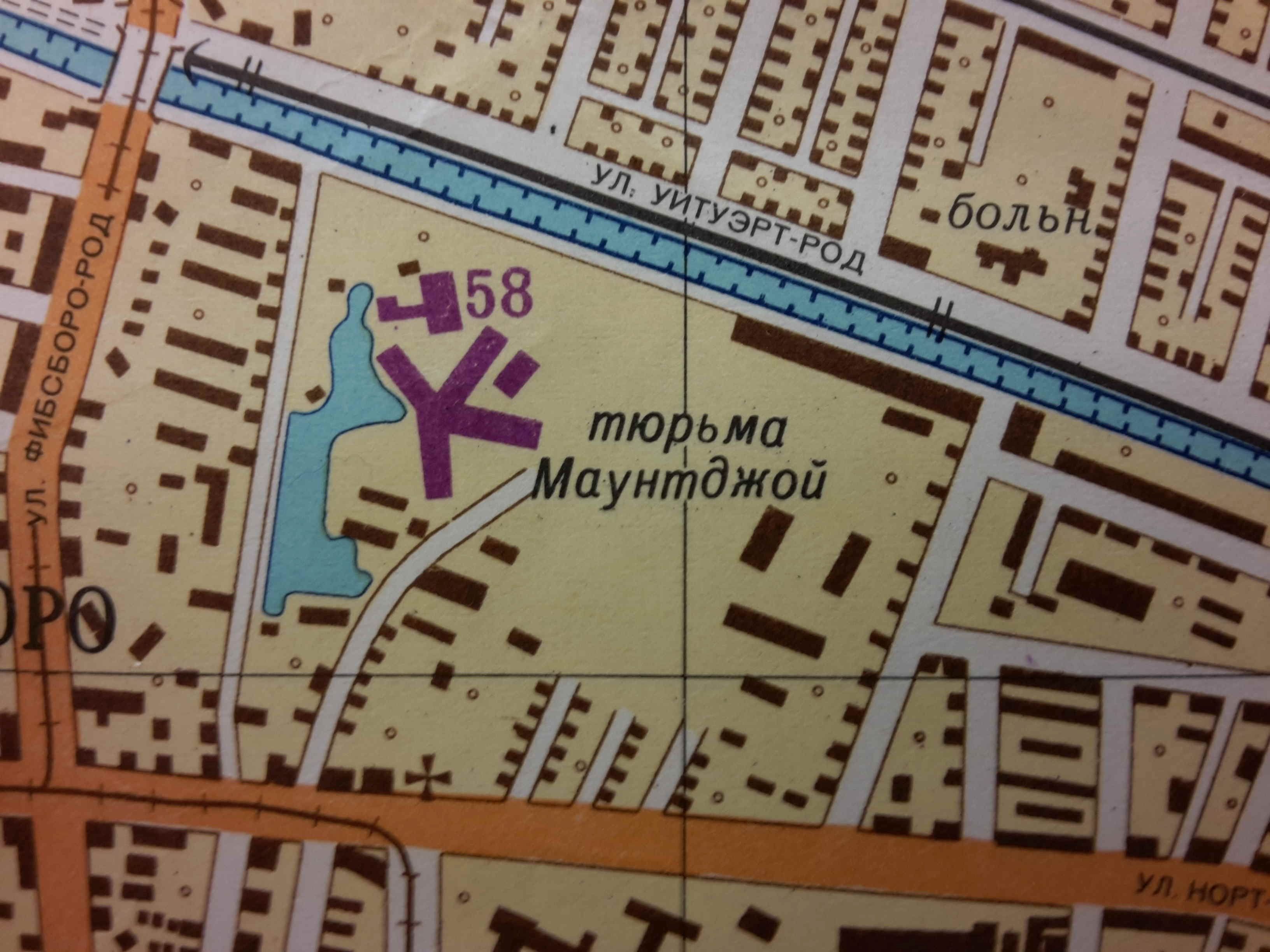
Below is shown what the prison looked like in the 7th of December 2013. I was not impressed (even for 1980) of the cartographic standard of this series of maps of Dublin. There is very little details shown below. The street symbology follows no hierarchy, the labeling is inconsistent and poorly executed and there is virtually no detail on buildings, save for the odd ( and worryingly uniform, even taking into account the large percentage of semi-detached dwellings in this area). To prove the point, I georeferenced the section of the map that I had and overlaid it on satellite imagery. The results are shown below, as usual, hospitals, railways and industrial areas are well marked but residential detail is sorely missing.
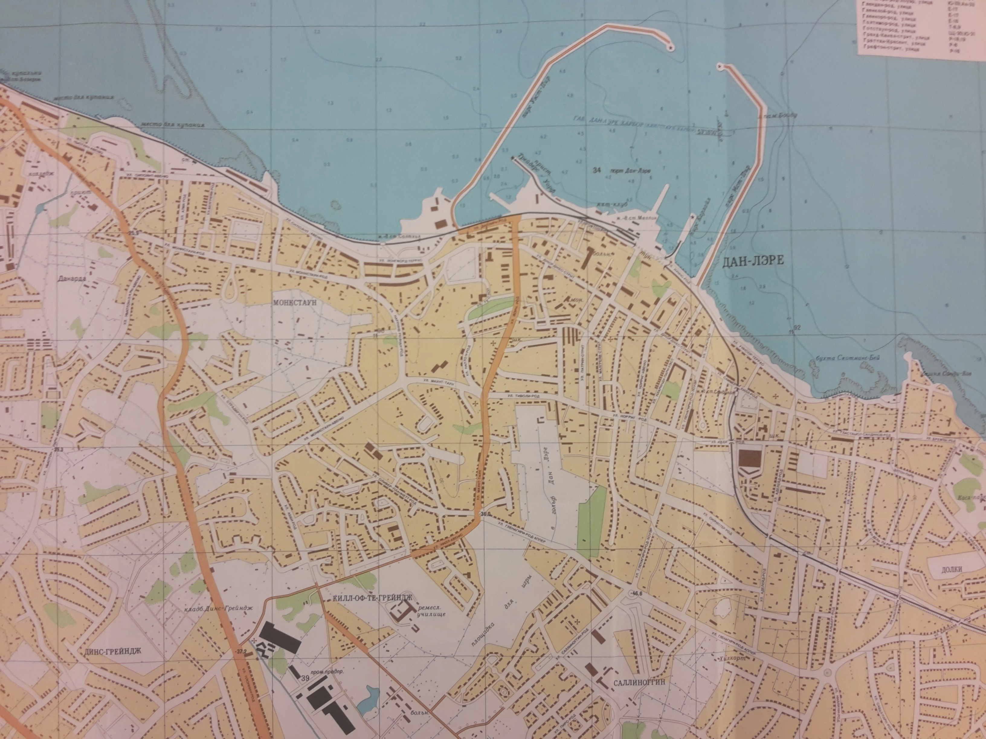
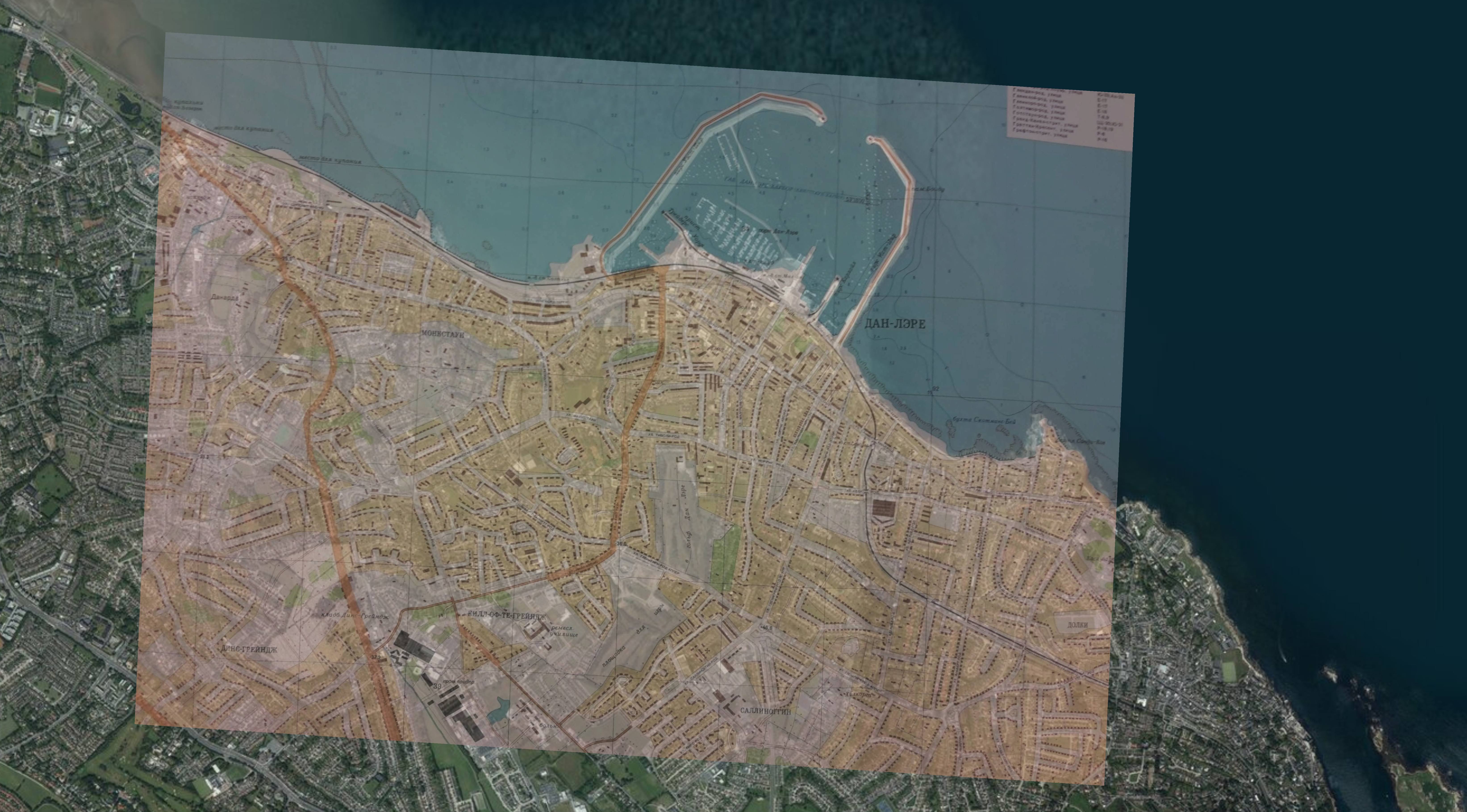
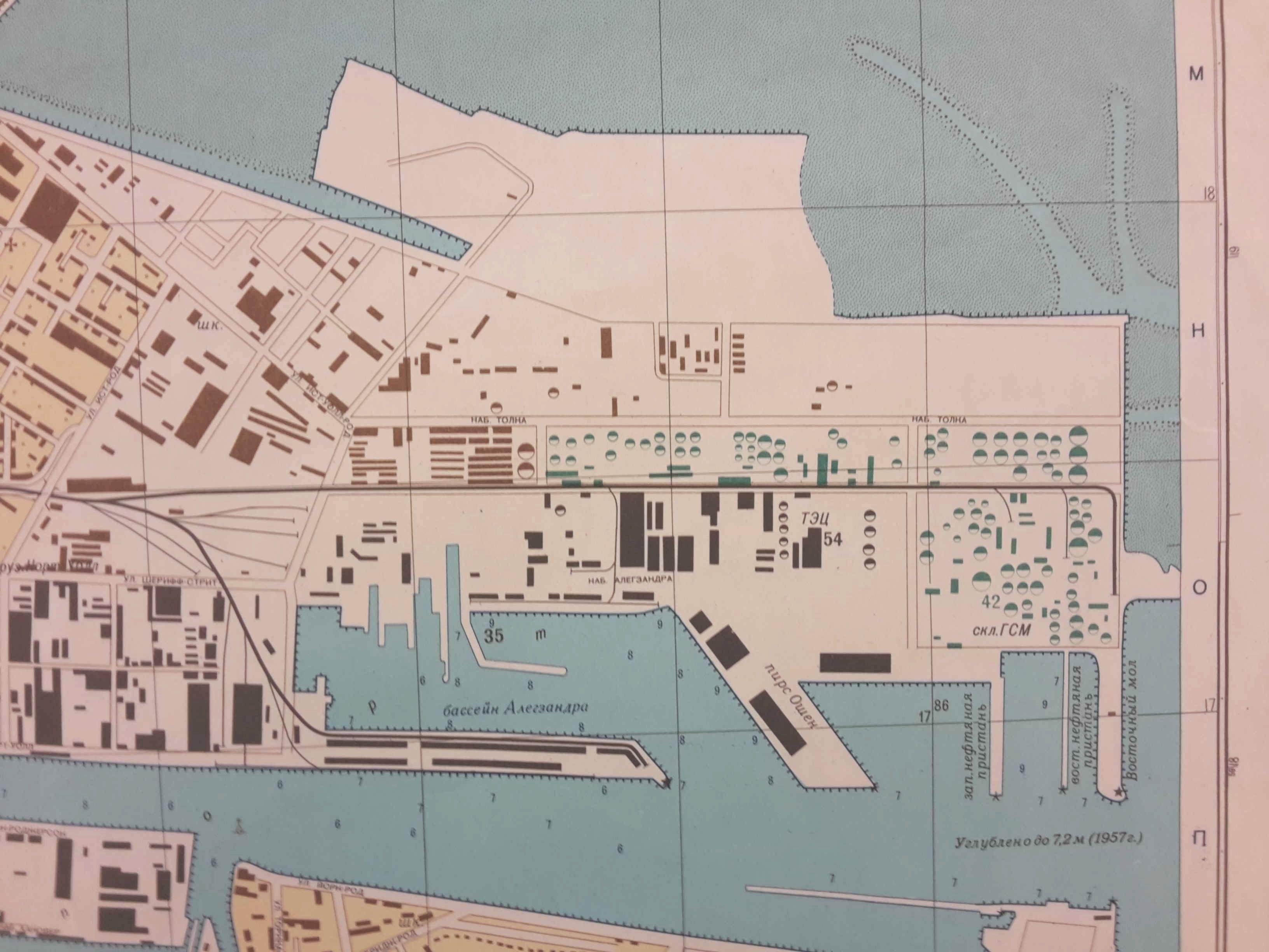
Albeit crude, the above image gives a good idea of what the Russians were missing out on in Dún Laoghaire. I have checked their coordinates the mount of the harbor and they are accurate (I didn’t doubt this, I thought it was just fun to check!). The last image I’m going to show from this quick look at Dublin is the docks, specifically, Grand Canal Dock and the Ringsend Area. As they would most likely have used Ireland a staging post to invade the UK, they went to considerable lengths to get the dock and the hydrography correct as shown in the image below where almost every building of strategic consequence is mapped.
I hope to update this most when I can source OSI maps from circa 1980.