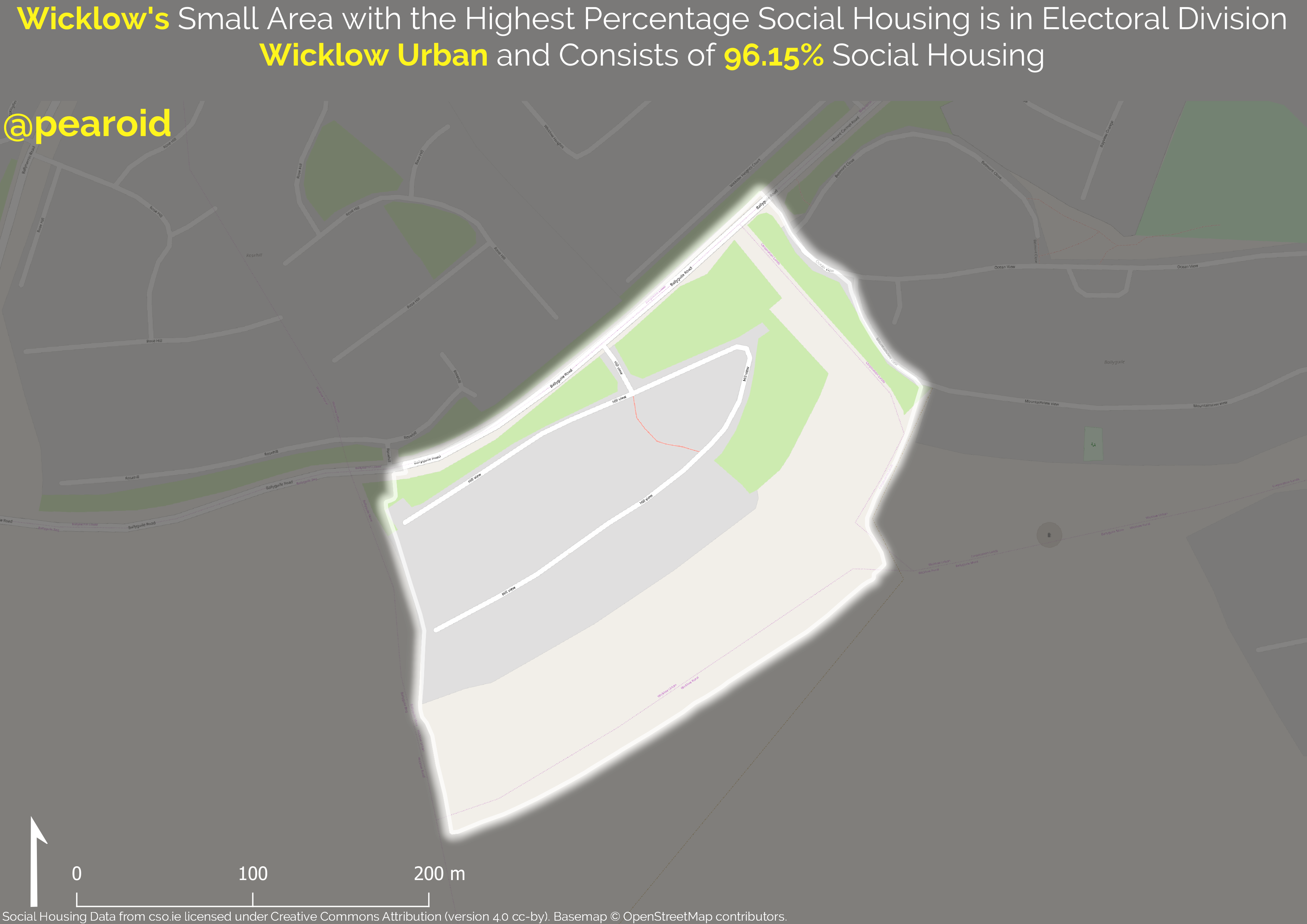
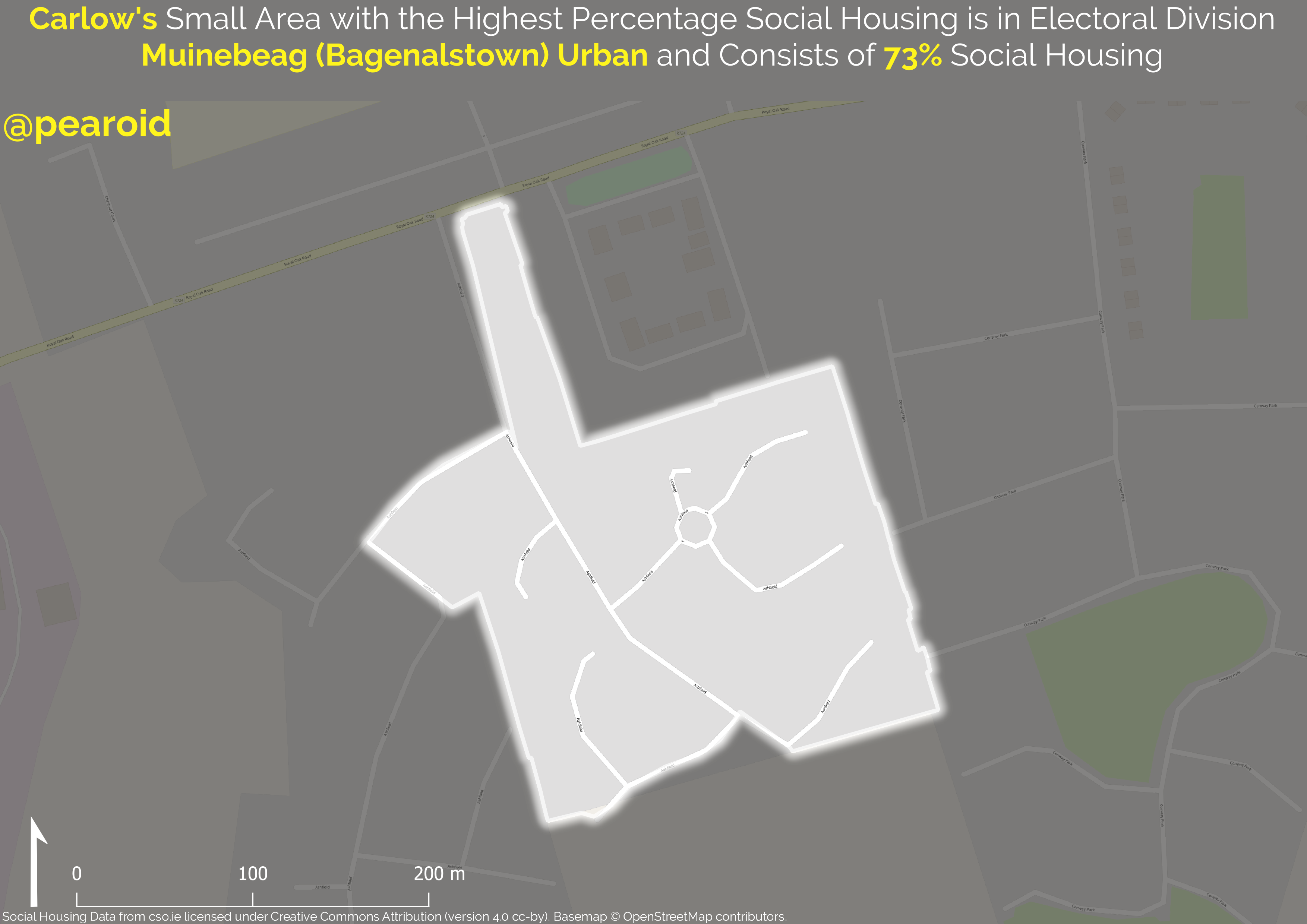
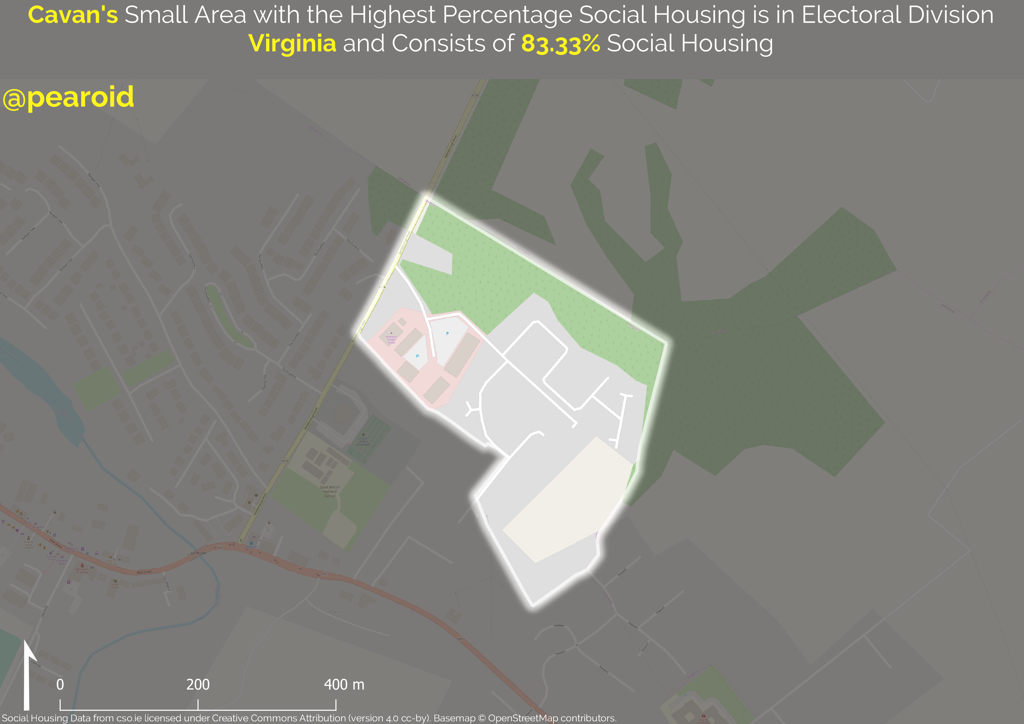
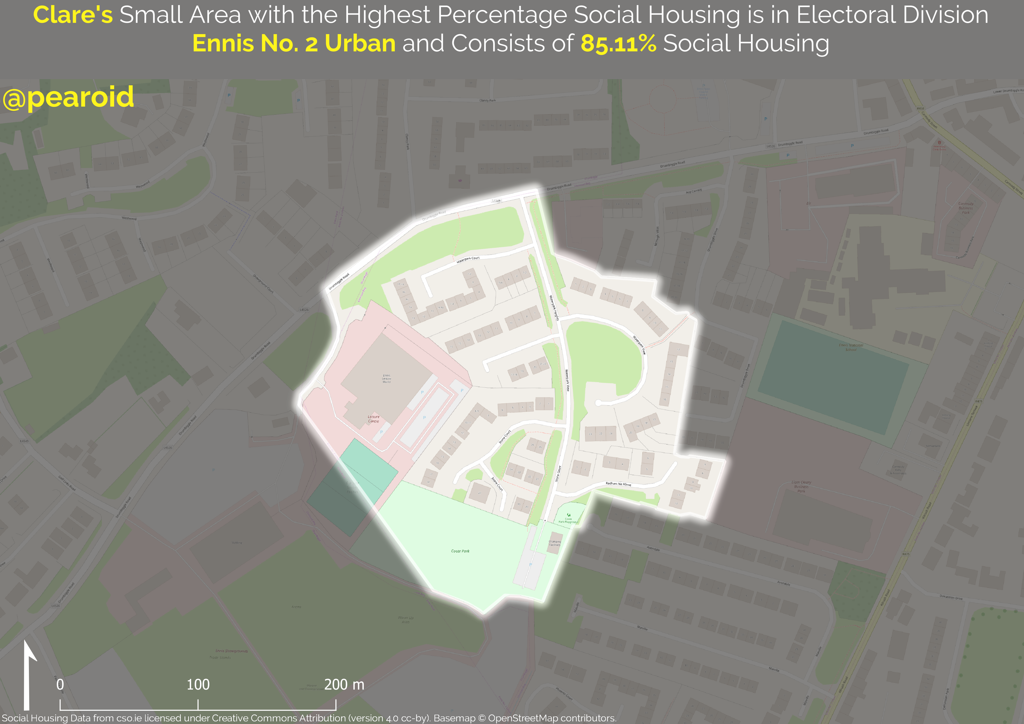
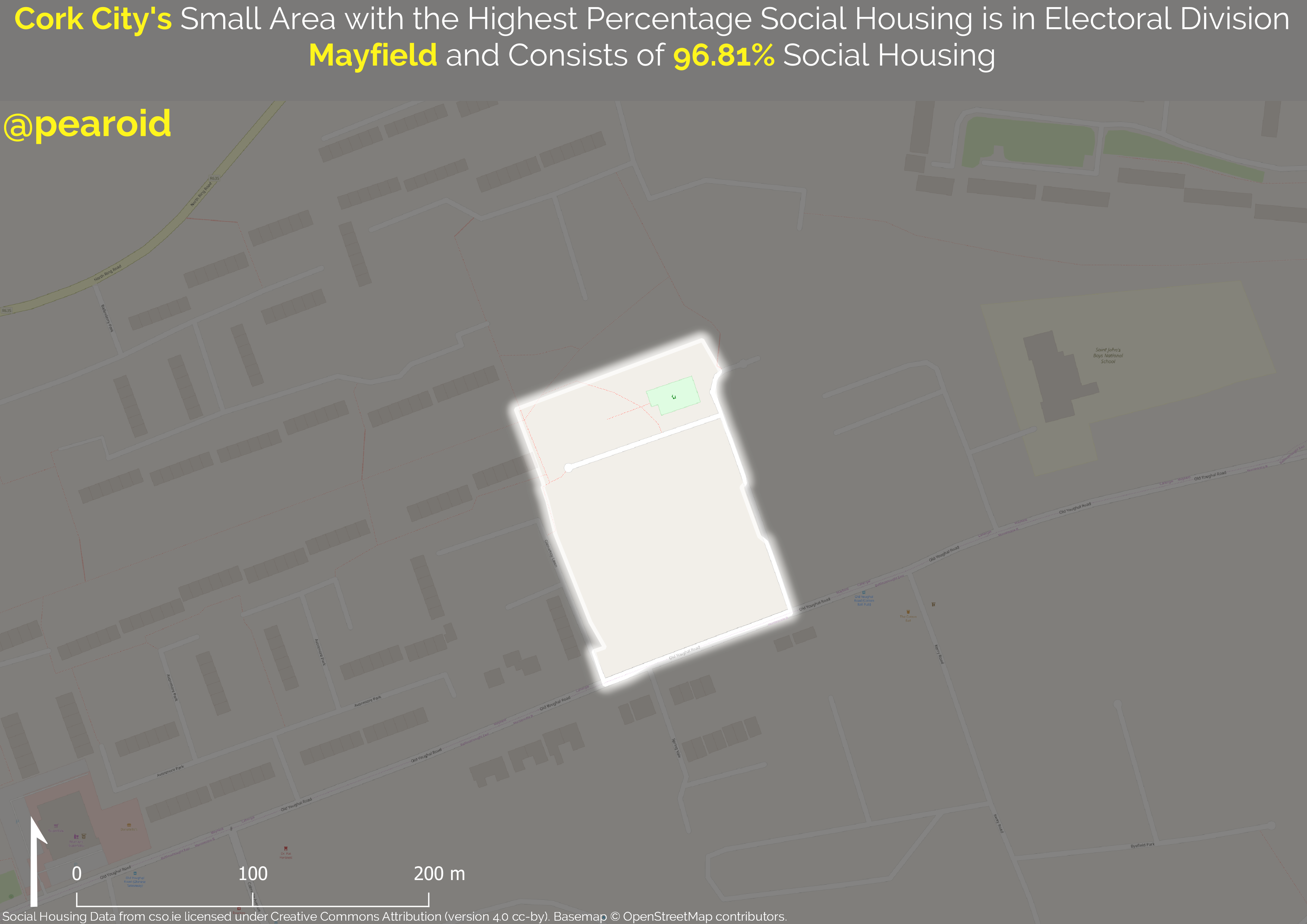
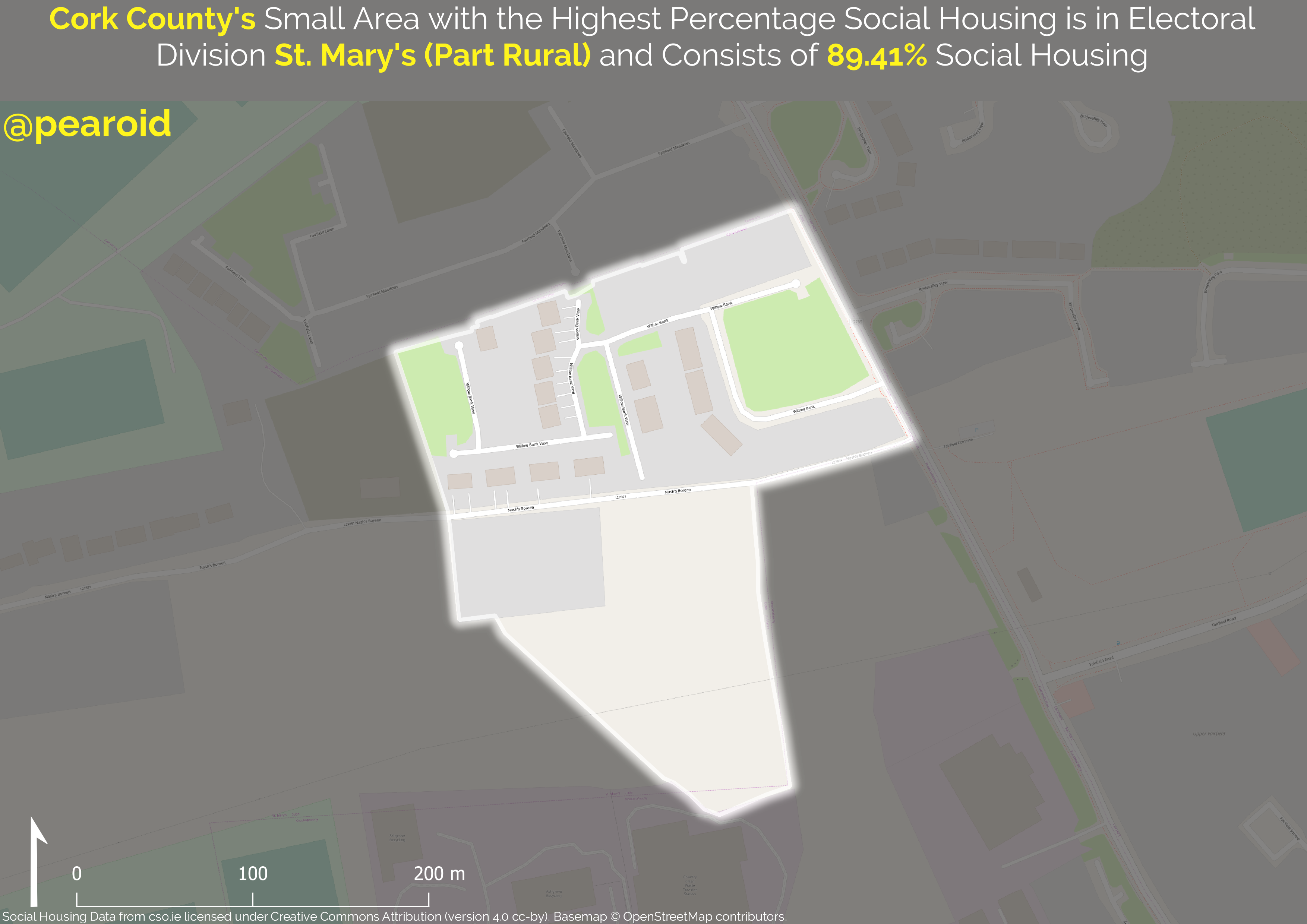
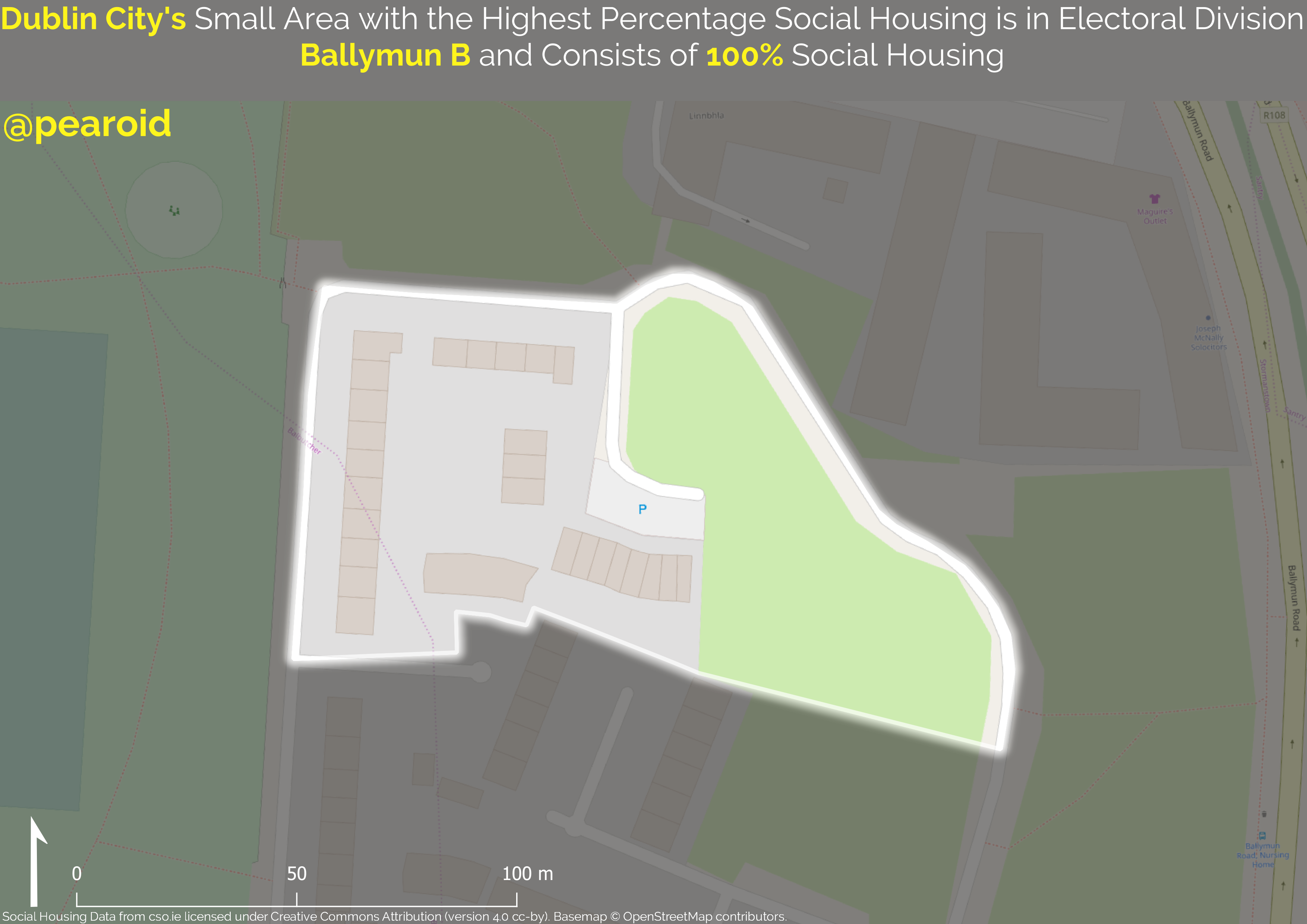
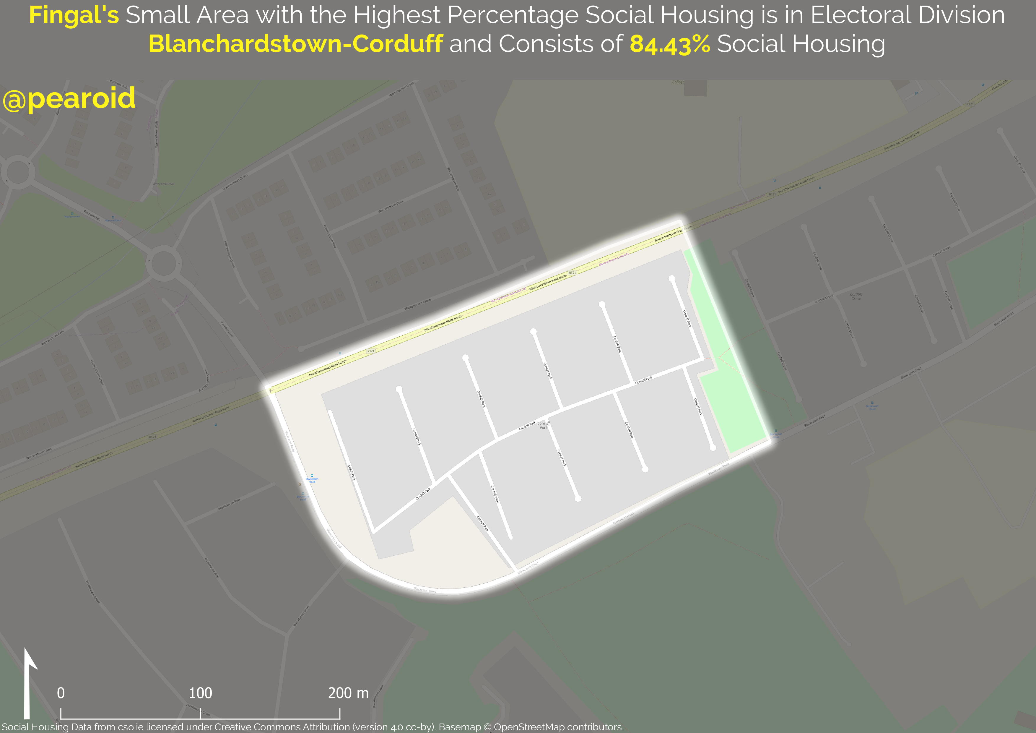
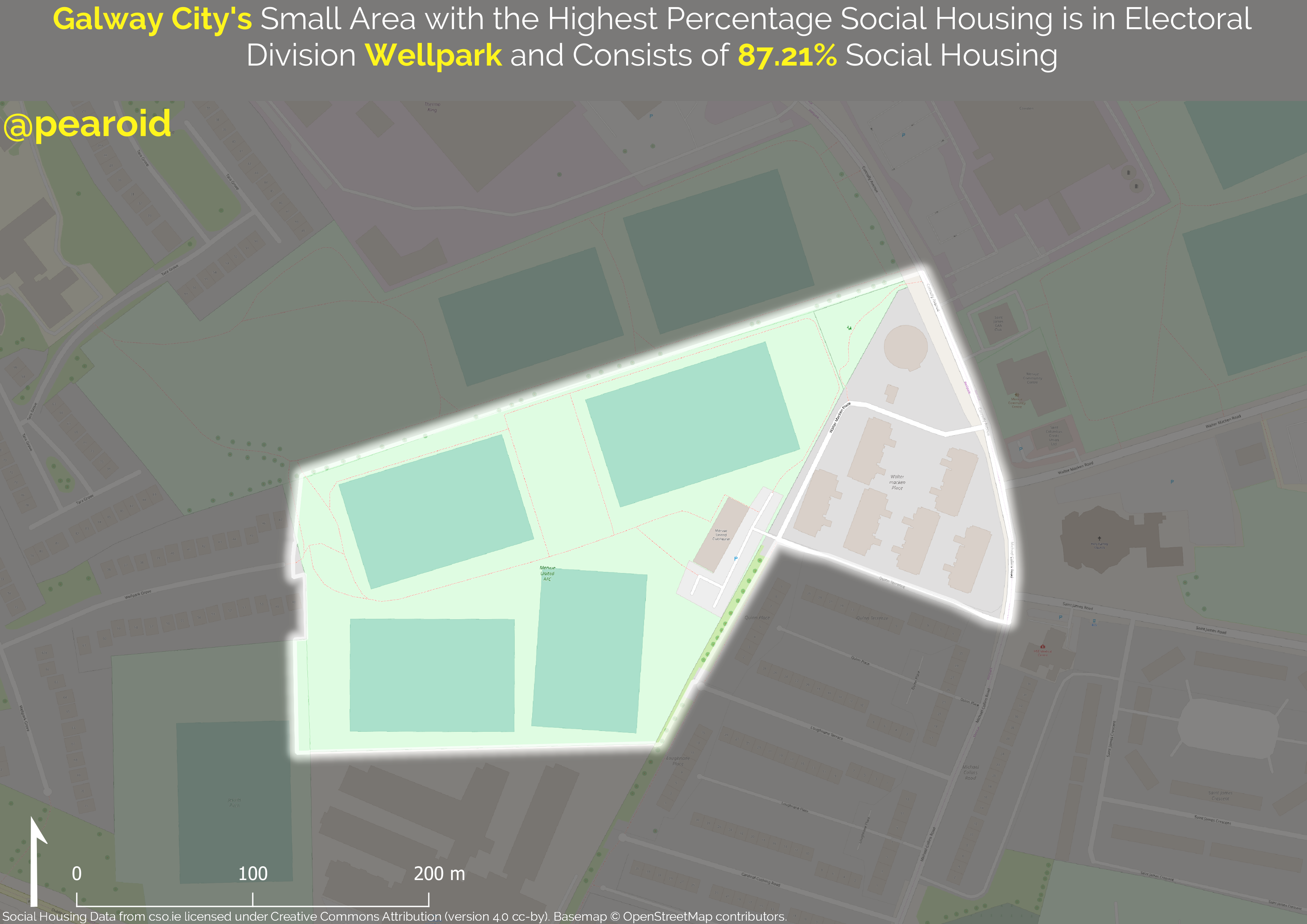
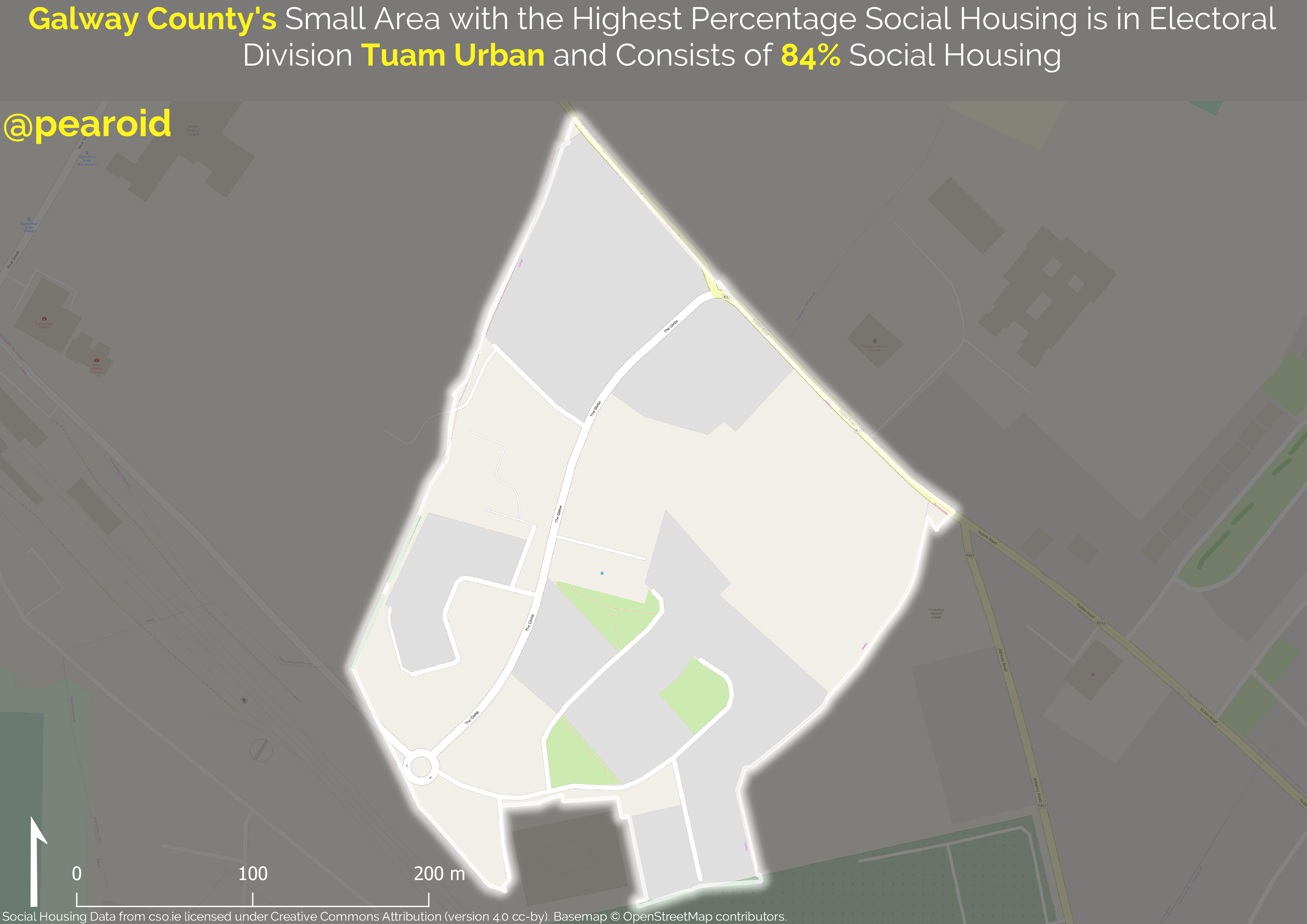
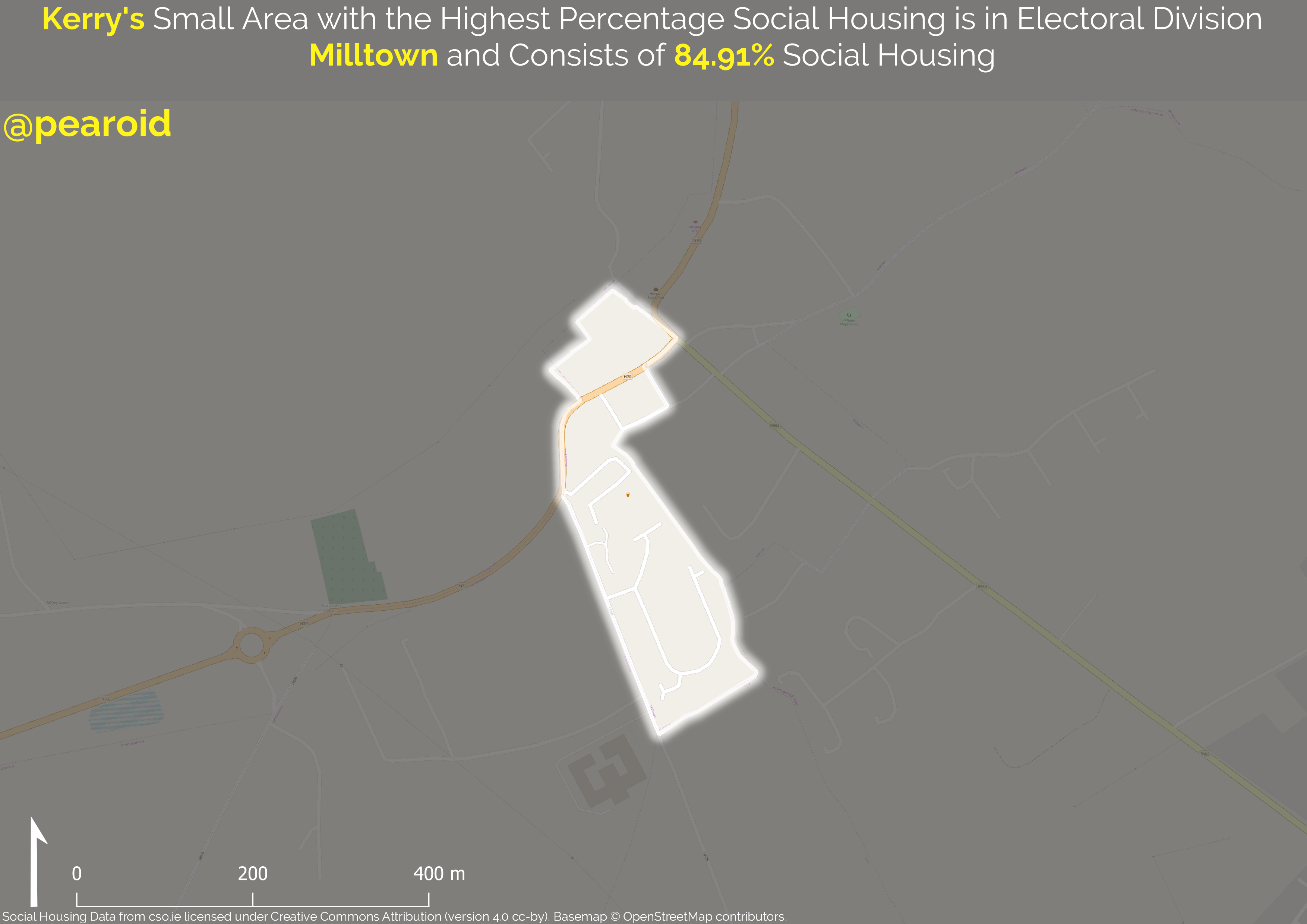
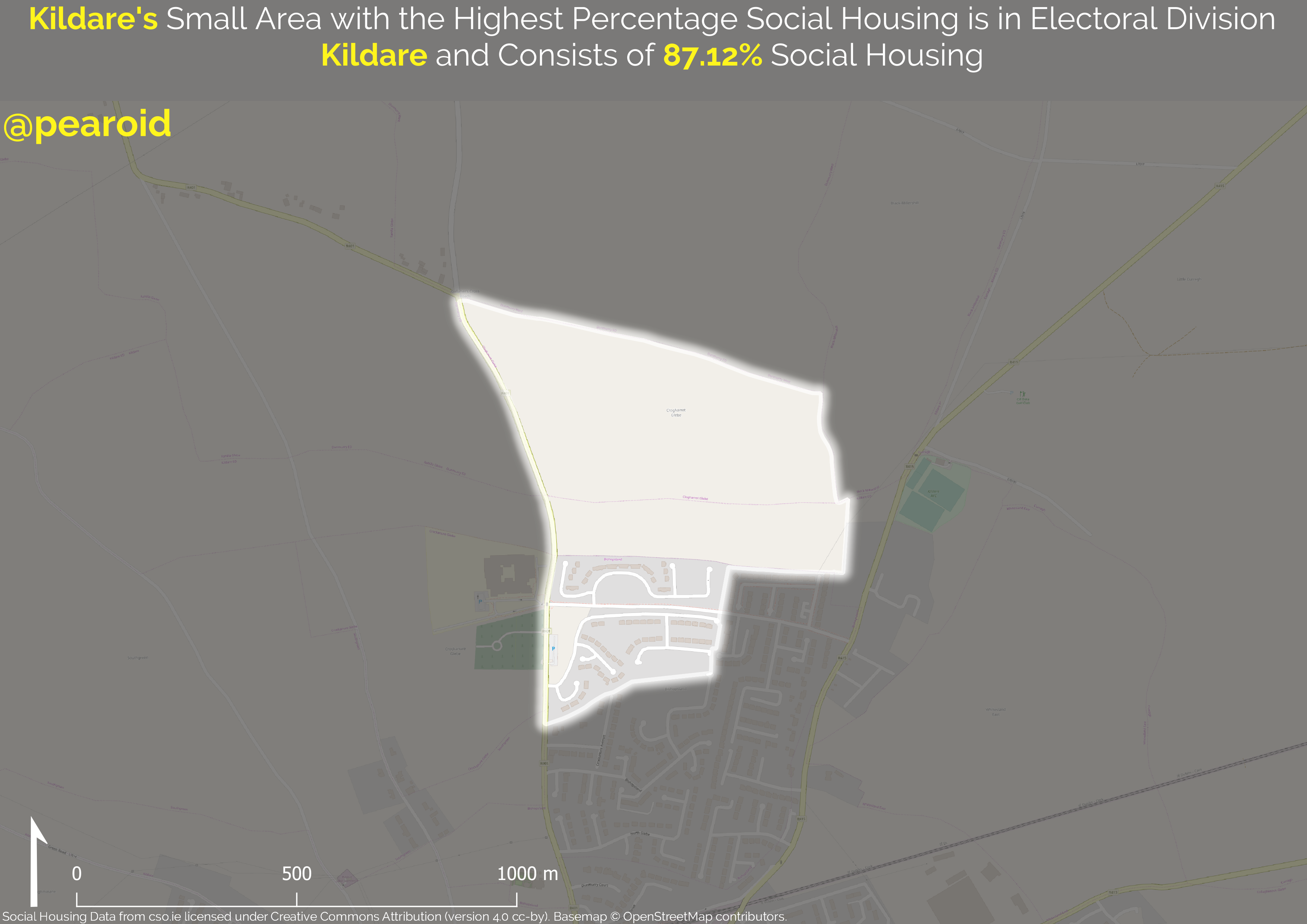
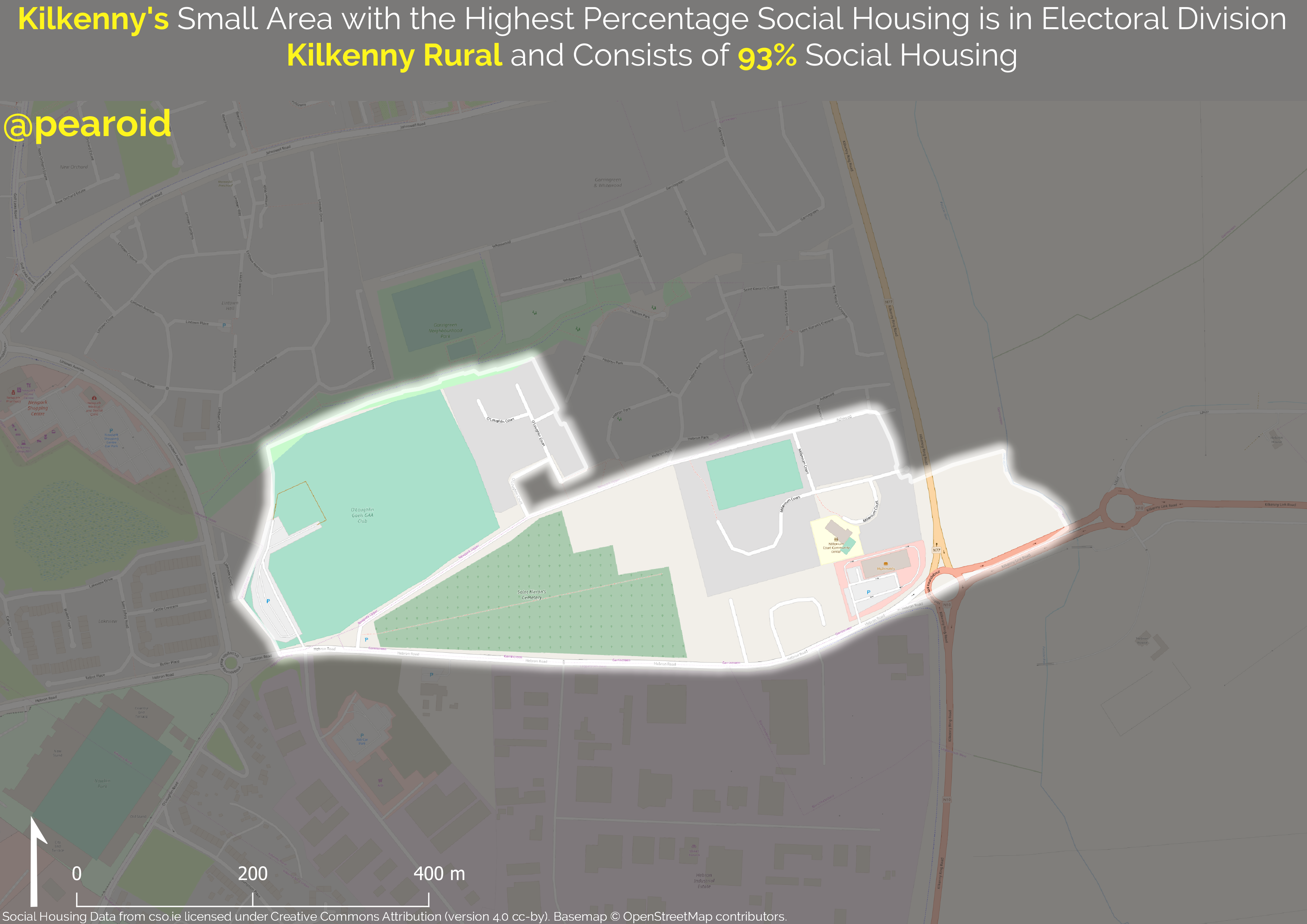
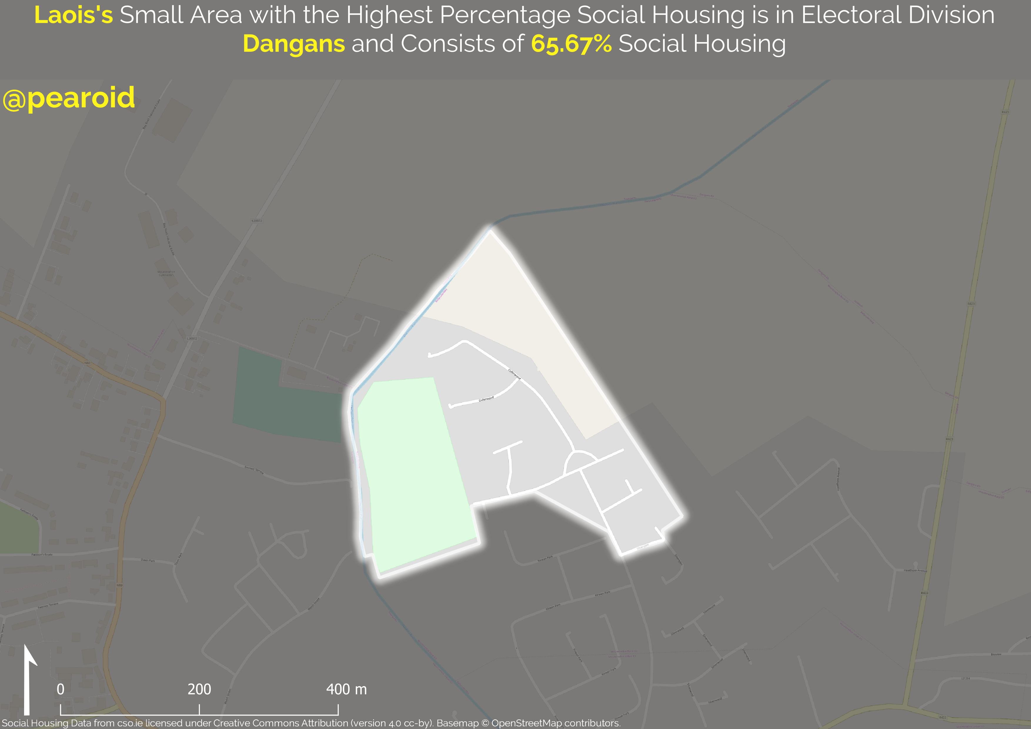
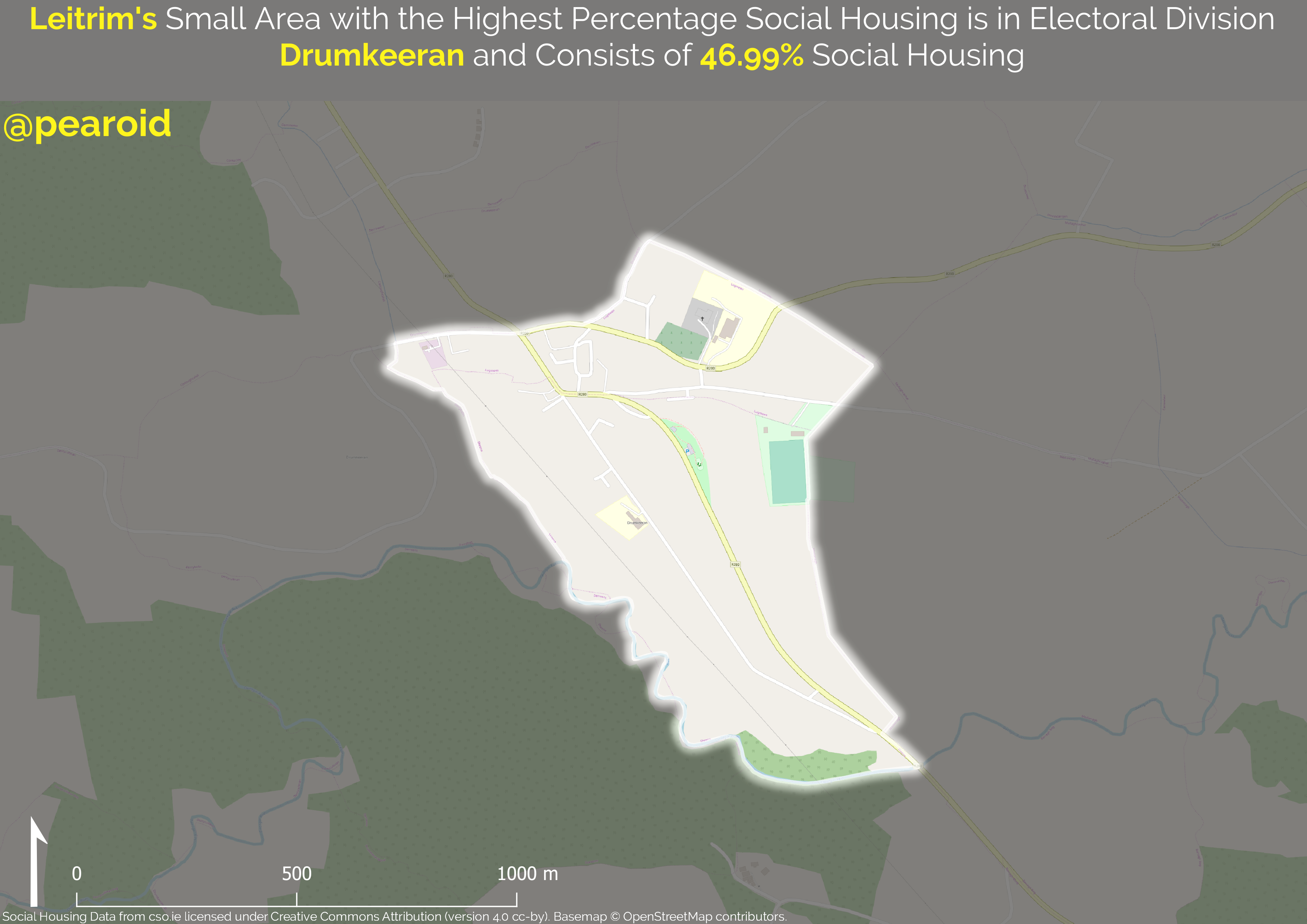
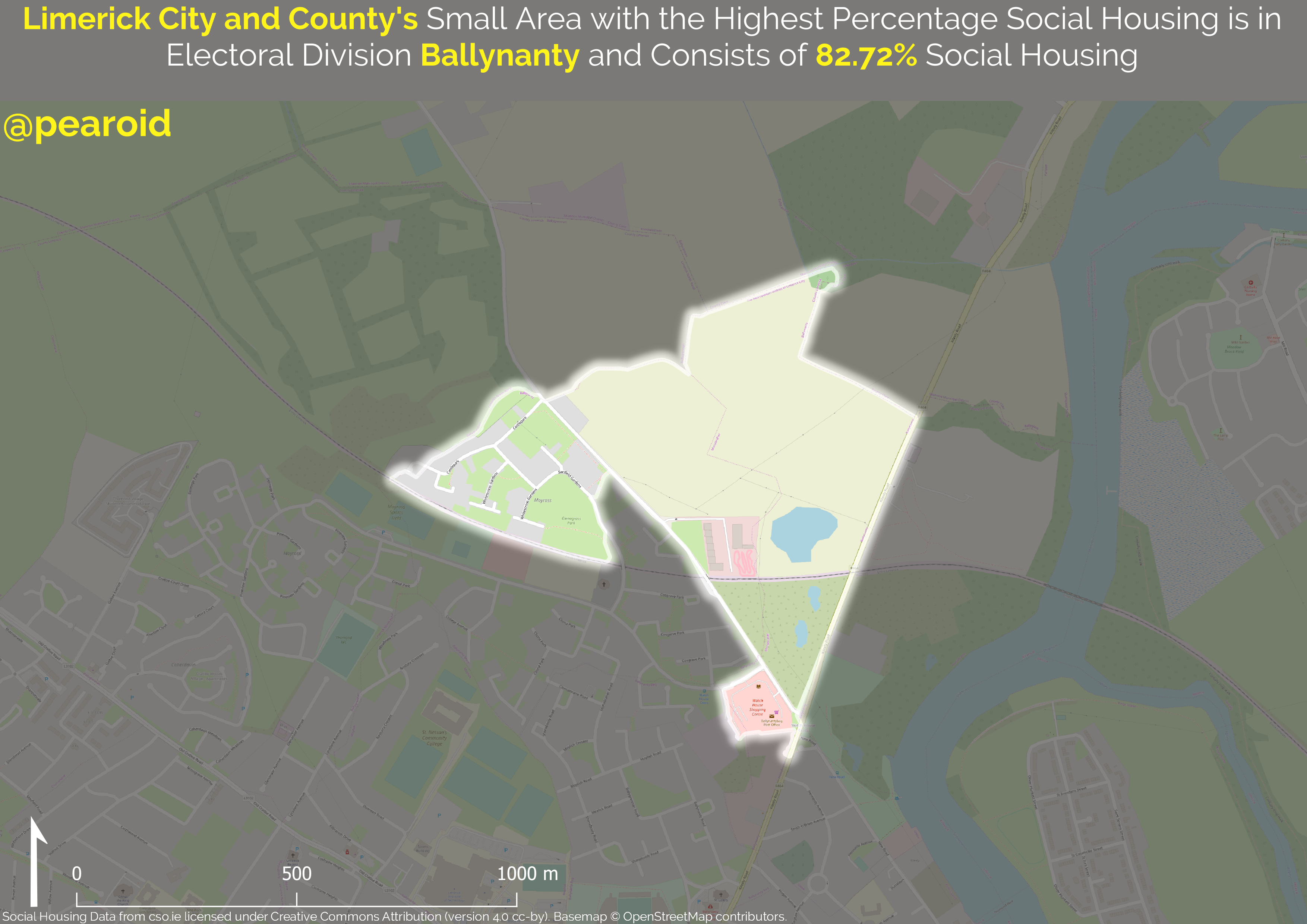
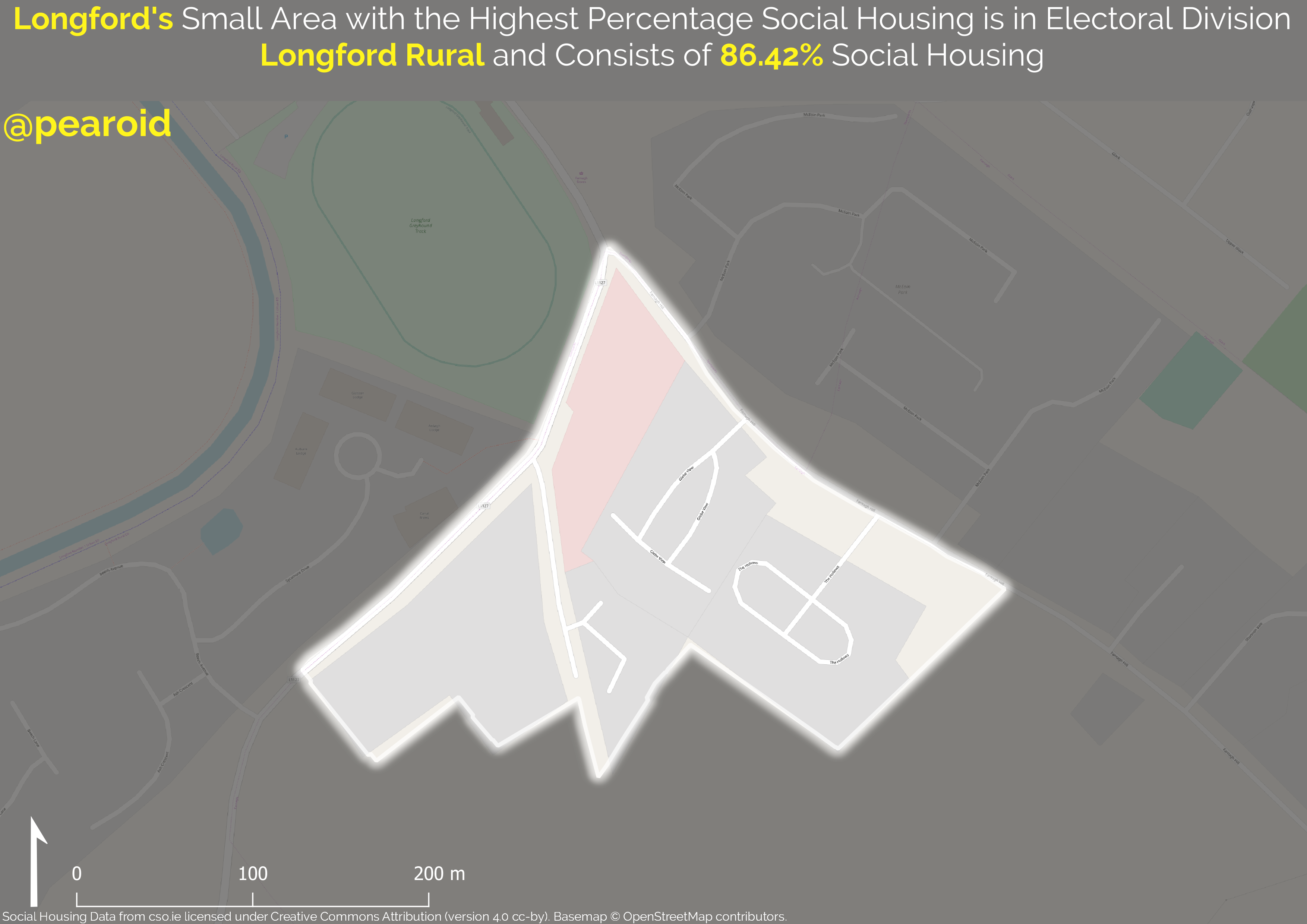
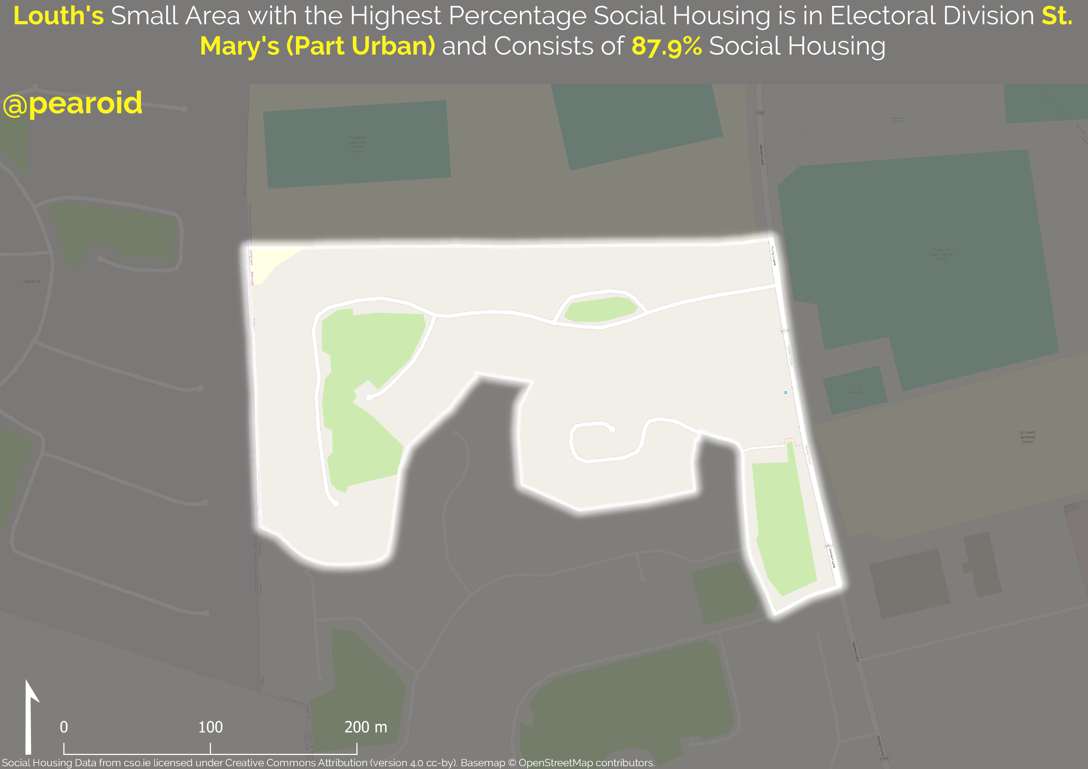
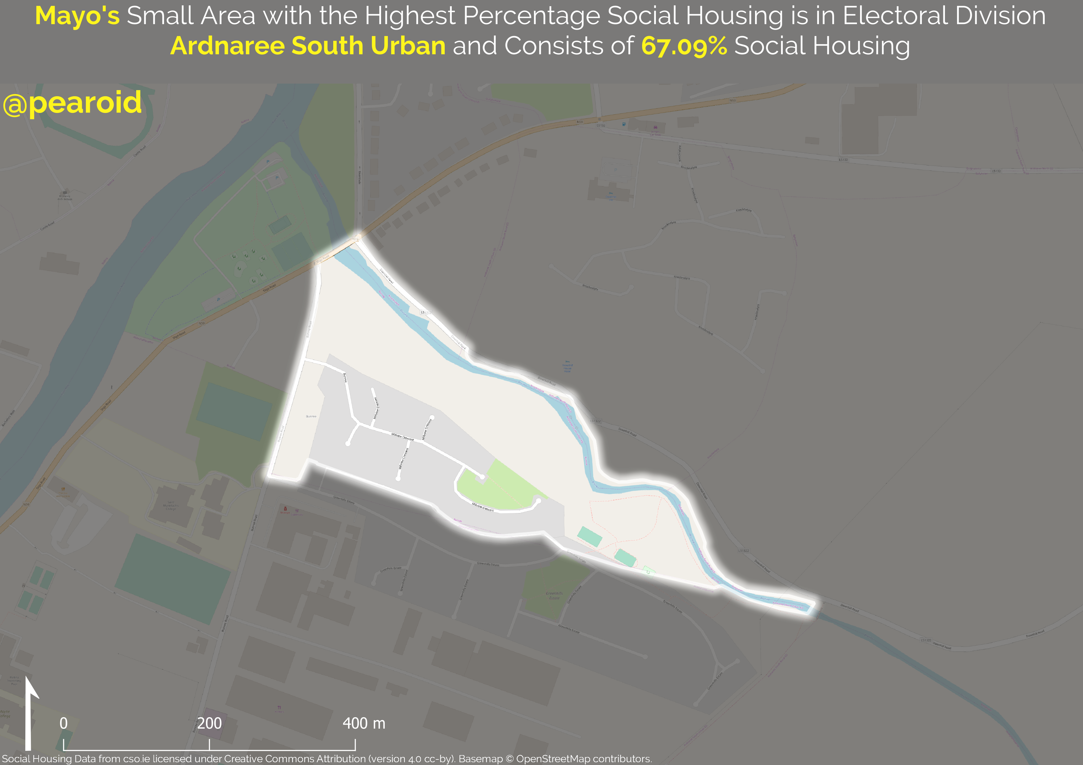
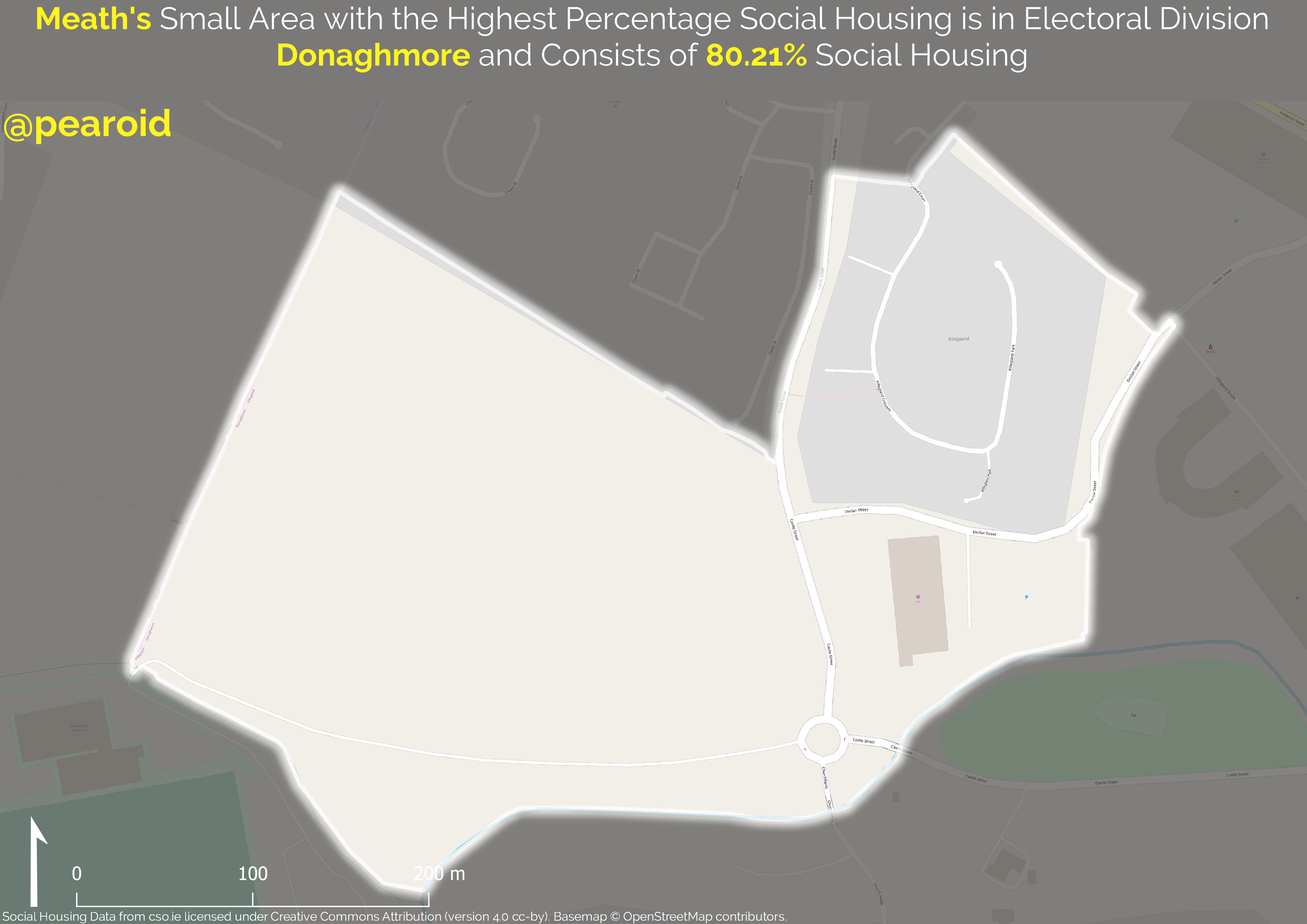
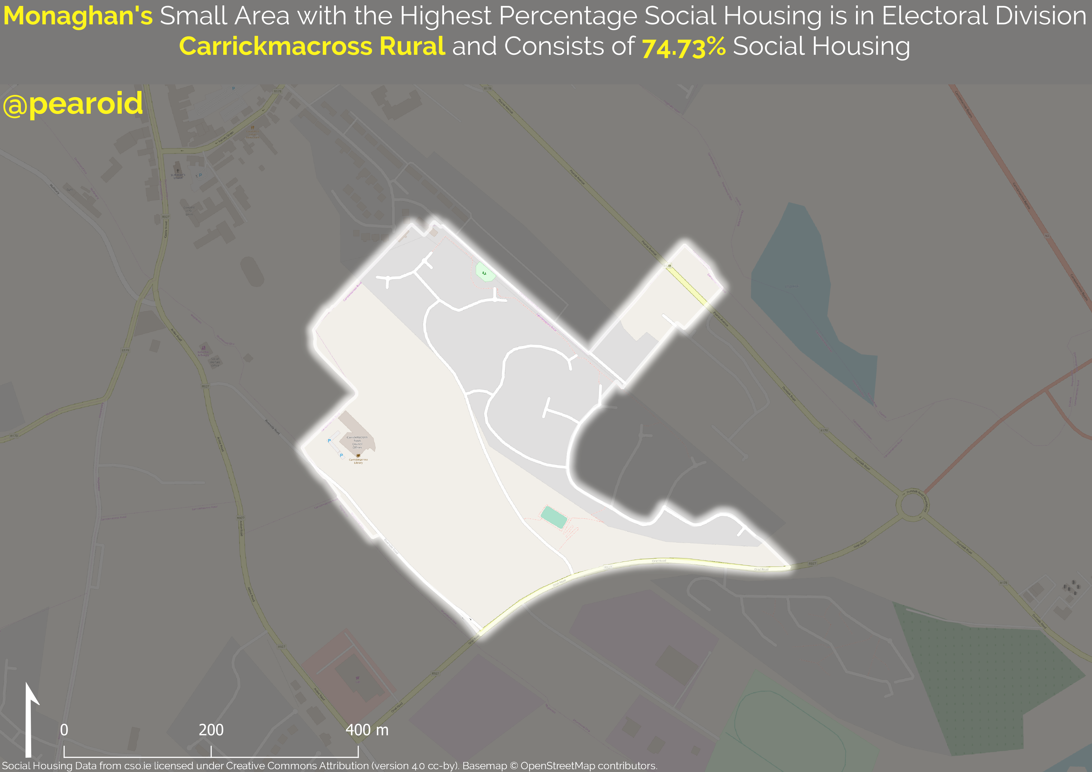
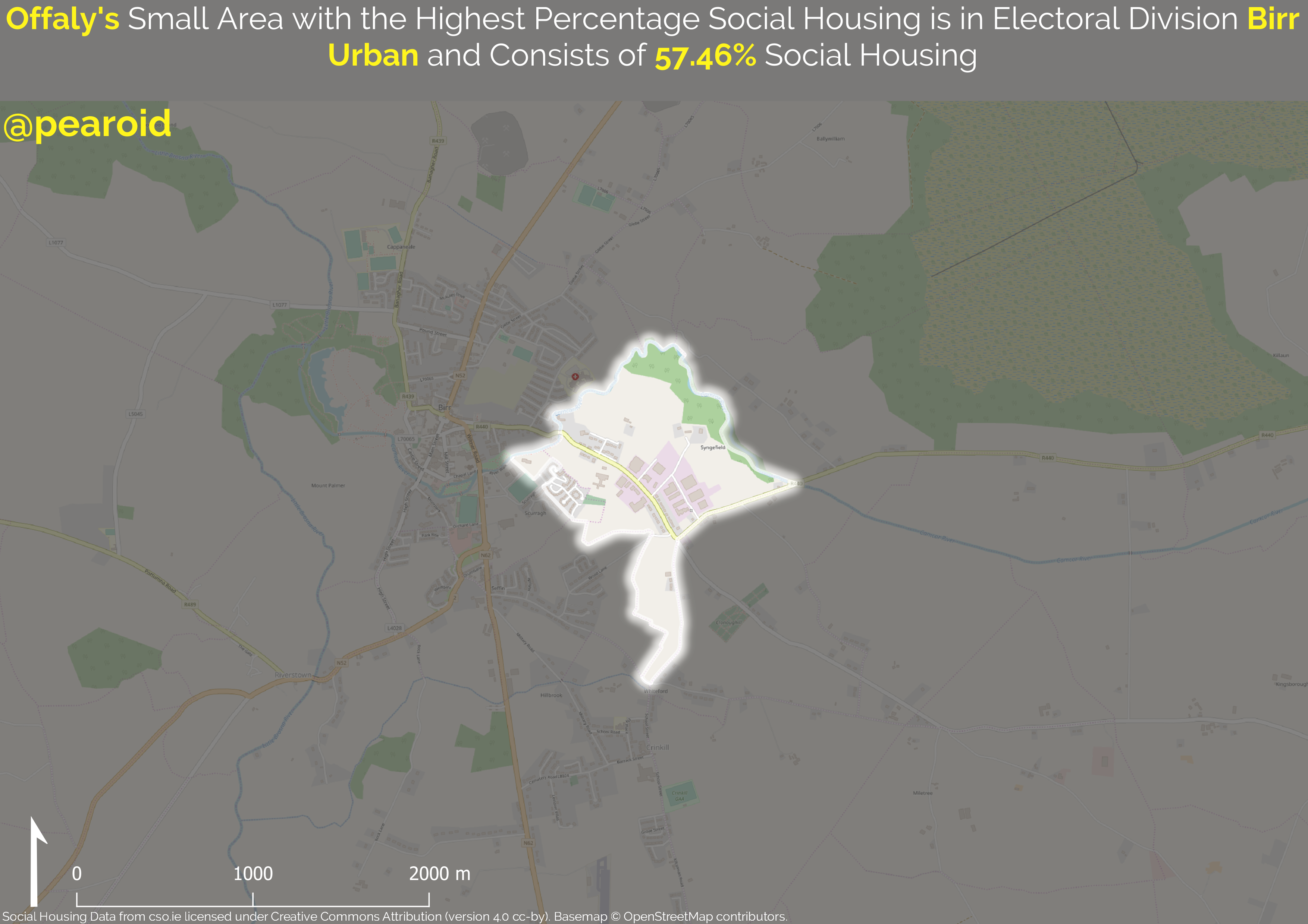
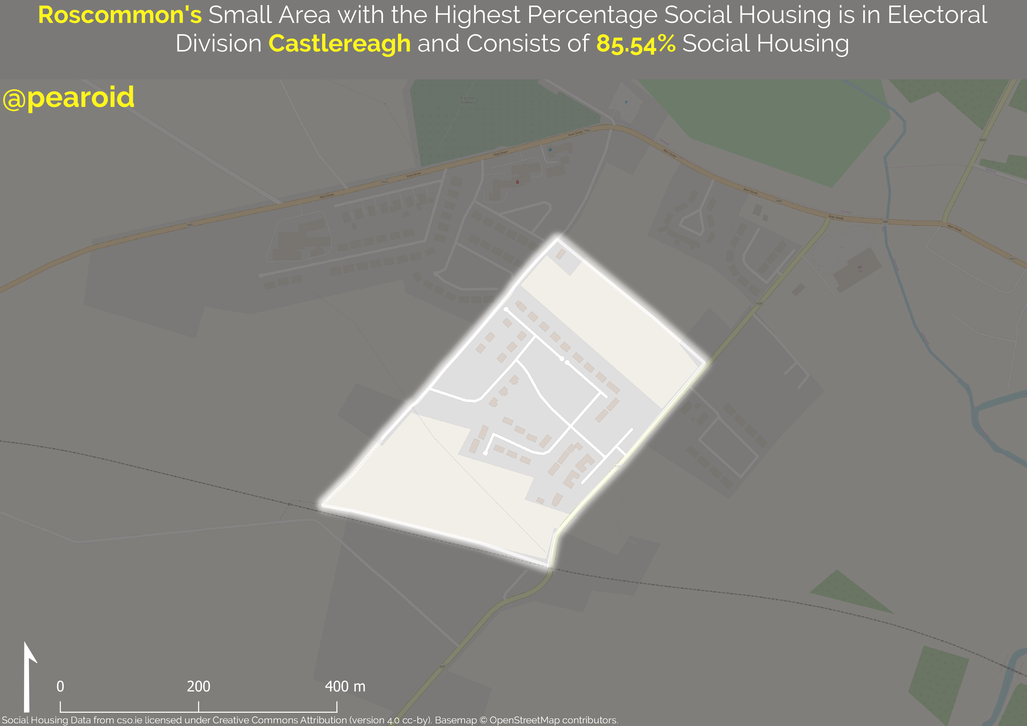
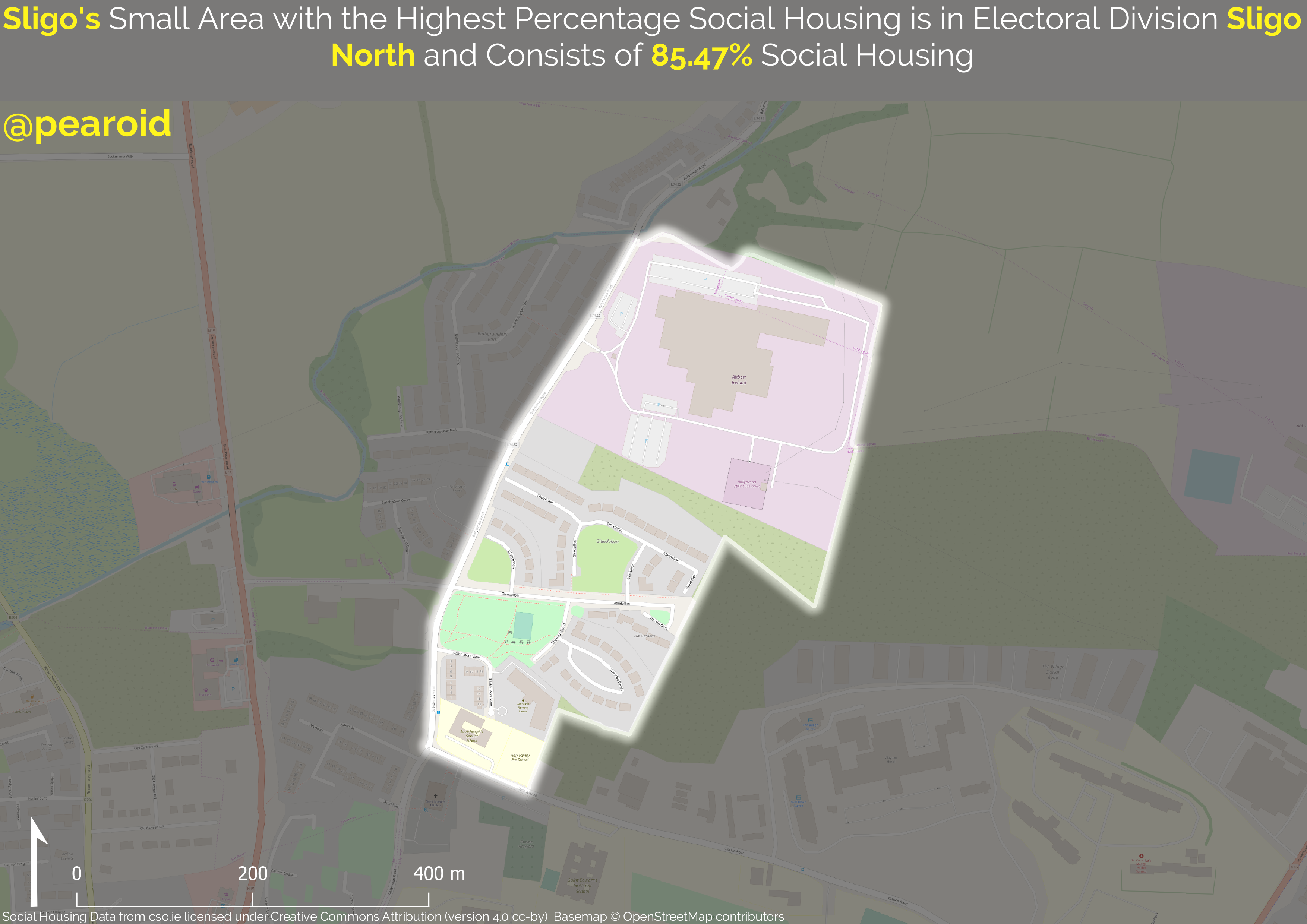
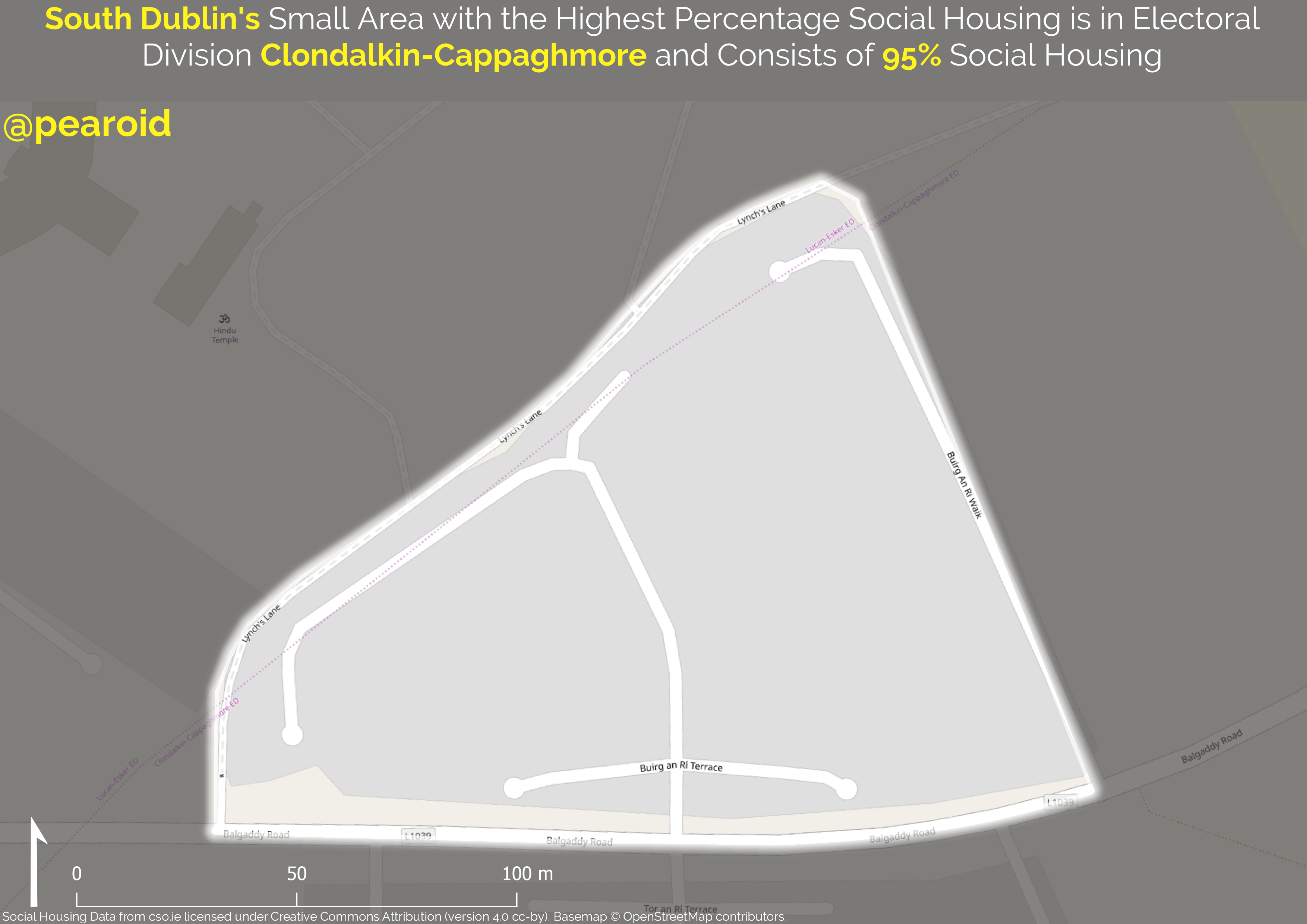
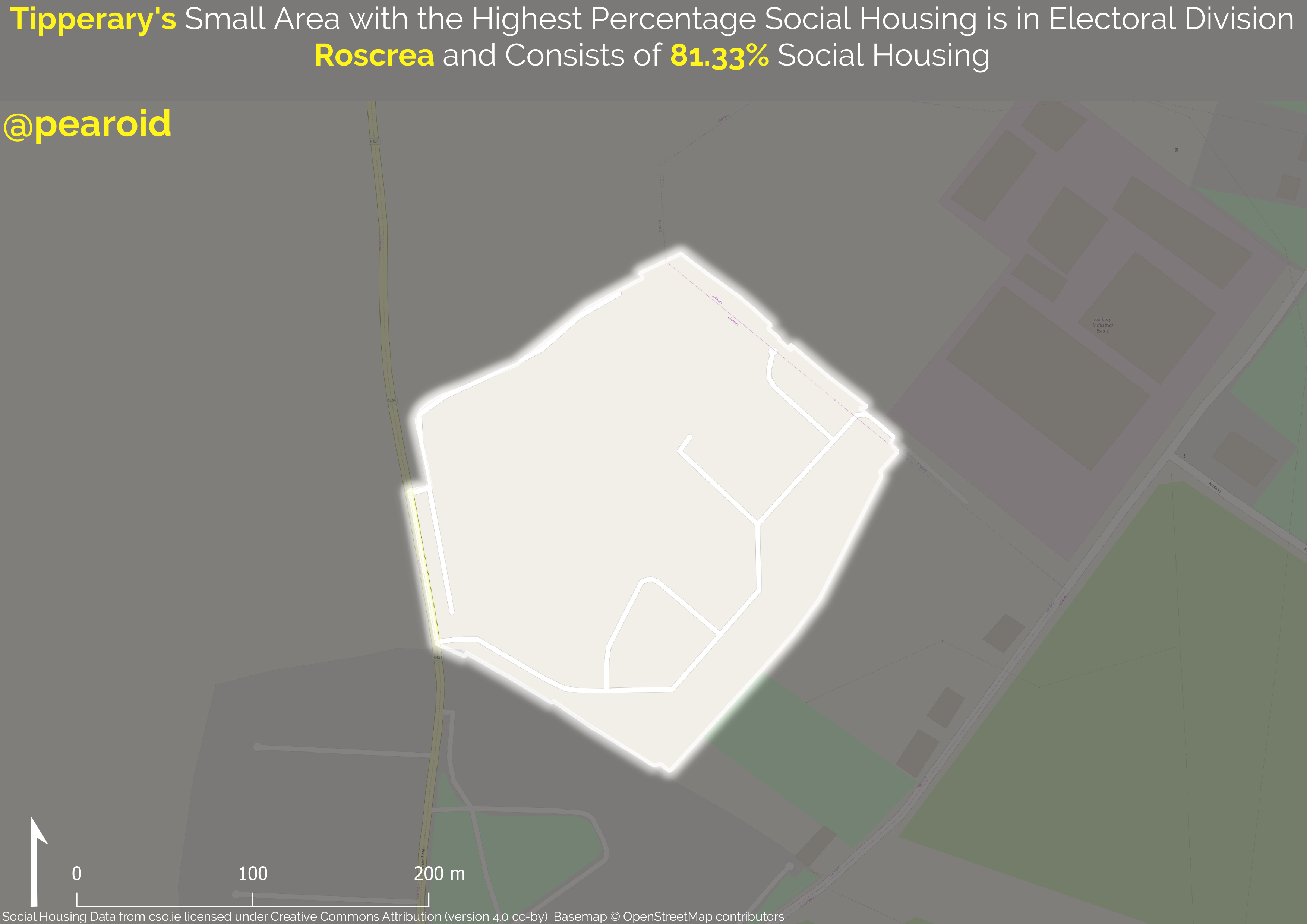
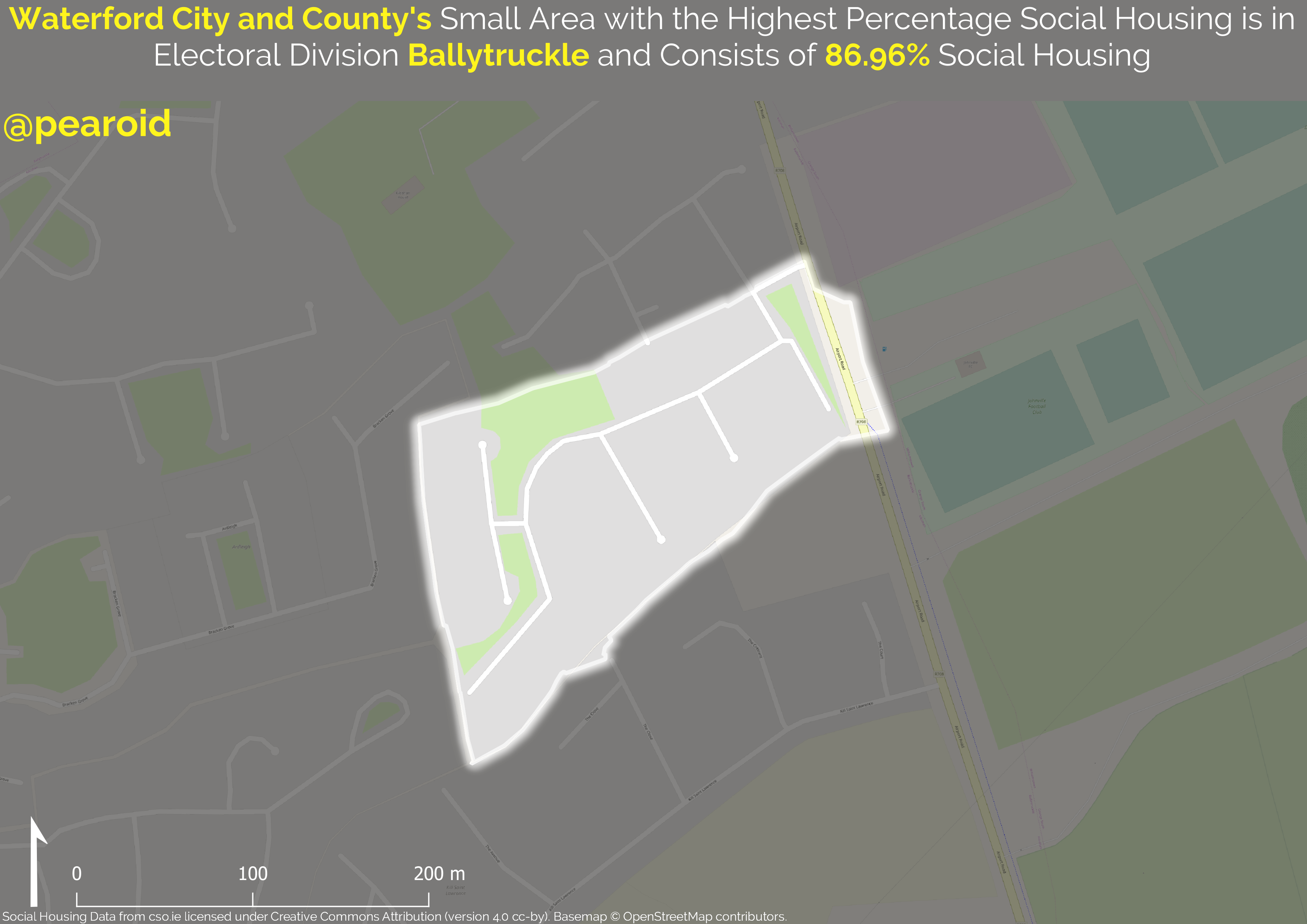
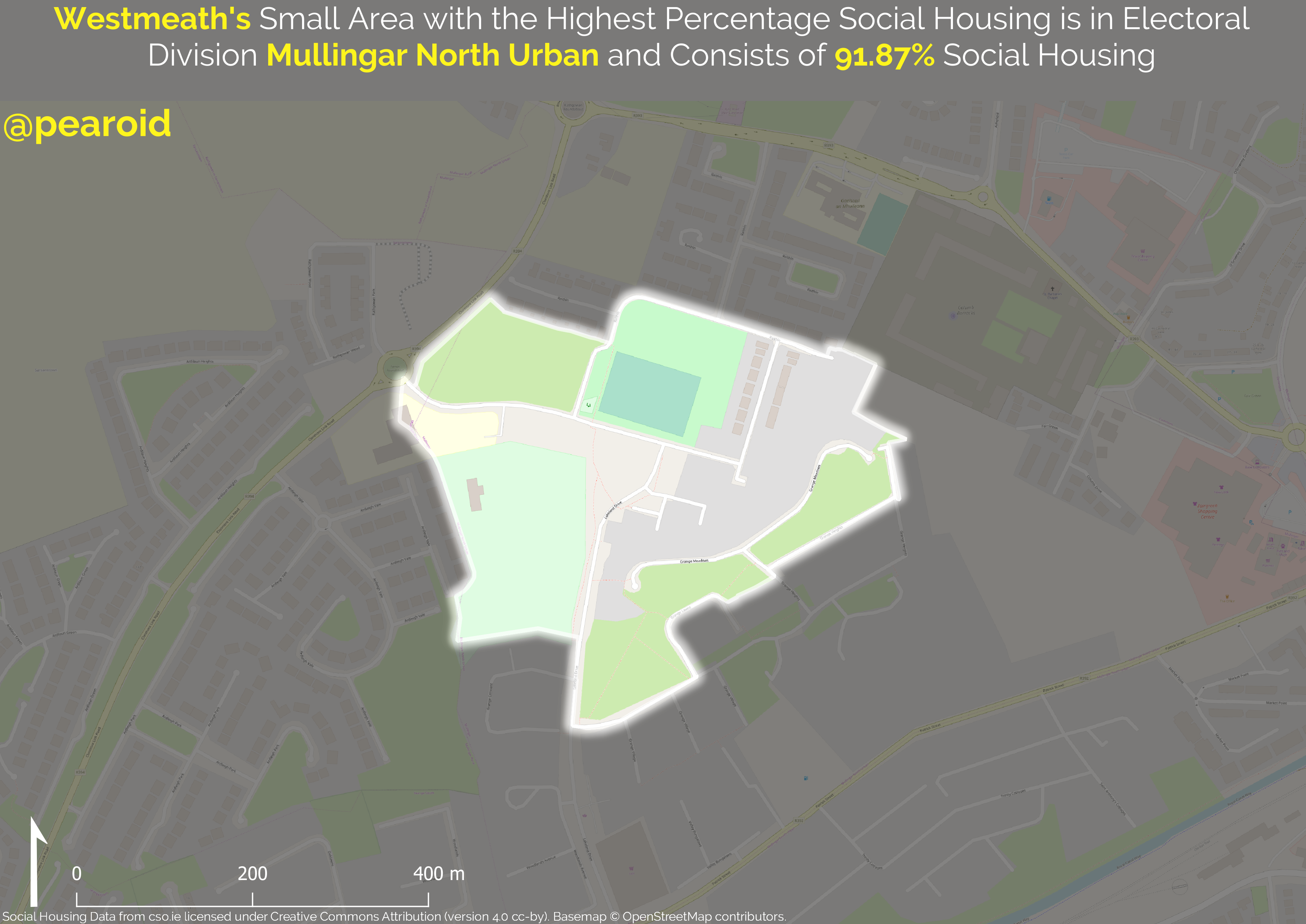
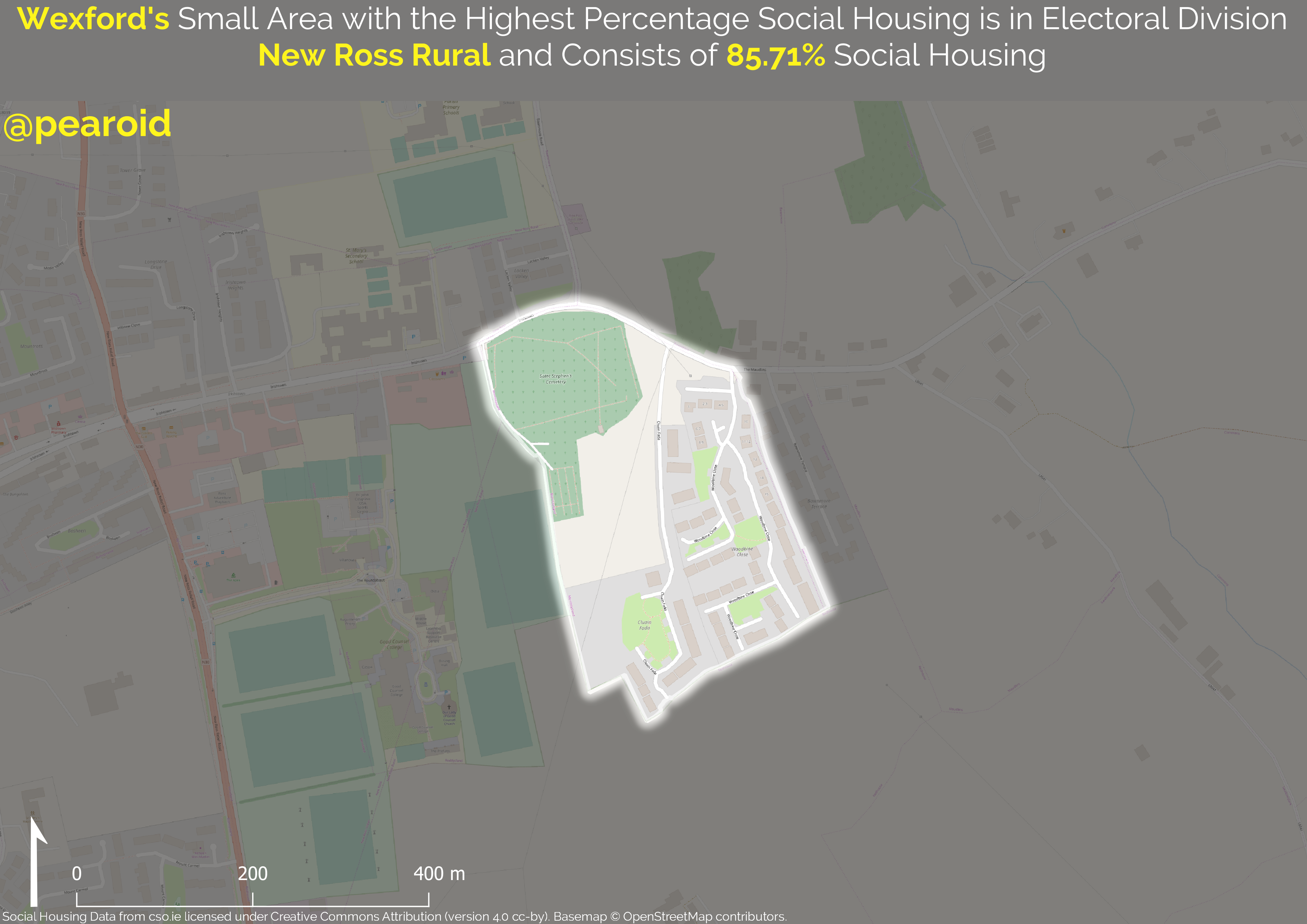
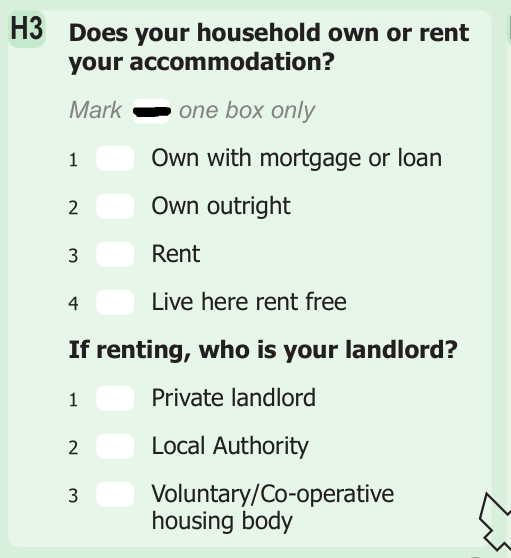
Housing and all its intricacies have come to dominate the media discourse at home over the last few years. We’ve truly come out the other side of the recession and now the conversation is around the shortage of housing and where that has lead us. I’ve been thinking about this recently and in particular social housing. I think that most people assume that we built the majority of our social housing in the 1950s and 1960s. Collectively I think we assume we know when social housing was built but not where. This is where the census data can come in. Part 2 of question H3 in census 2016 asks ‘If renting, who is your landlord?’.
I have all of the census 2016 returns for each geographical unit in a PostGIS database so it was a simple exercise to add the households that rent from a local authority or voluntary/co-operative housing body and divide by the total number of houses. One inherent weakness to this method is that it doesn’t capture the social housing tenants that rent from a private landlord.
I added a new column in PostGIS for the percentage social housing and I then symbolised this in QGIS. I used QGIS’s powerful Atlas generation tool. You’ll have to excuse the basemap, I’m aware that it’s a bit difficult to discern but in the interest of producing this entirely with opensource software I used OpenStreetMap as the basemap.
The next step will be to take the top-ten counties and use the Global Human Settlement Layer as a base to give an approximate indication of what epoch they were built in.