I was thinking the other week about the amount of bogs around Europe after the collapse of a trial against turf cutters in Galway. I put the below map and tweet together in a few minutes that shows the peatlands of Europe. The outlines of Iceland, Ireland, Northern England, Scandinavia and Scotland are visible from their peat cover alone. The data comes from the European Commission’s CORINE land cover dataset.
The peatlands of Europe #gis #cartography #europe pic.twitter.com/fiyMEyia6R
— Dónal Casey (@Pearoid) February 8, 2020
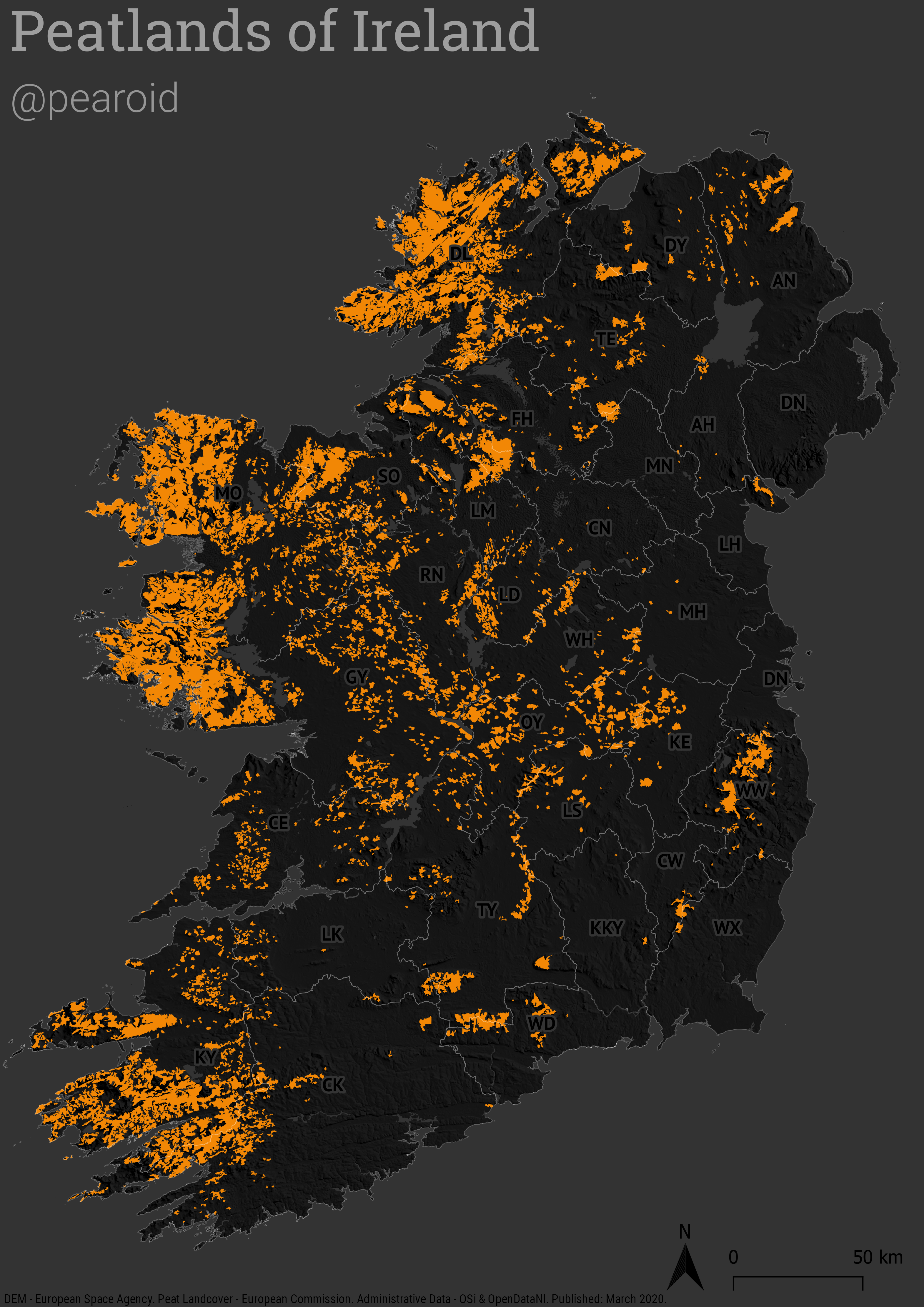
After completing the above I thought I’d put together a map showing the peat cover in Ireland. Besides from the CORINE land cover dataset I used a DEM from the European Space Agency to create the hillshade and the administrative data comes from Ordnance Survey Ireland and OpenDataNI. The dataset doesn’t differentiate between raised and blanket bogs but for my purposes that’s okay.
Below is the finished map. I tried something new and used abbreviated county name labels à la various maps for the USA where the state names are abbreviated. I think it works well.
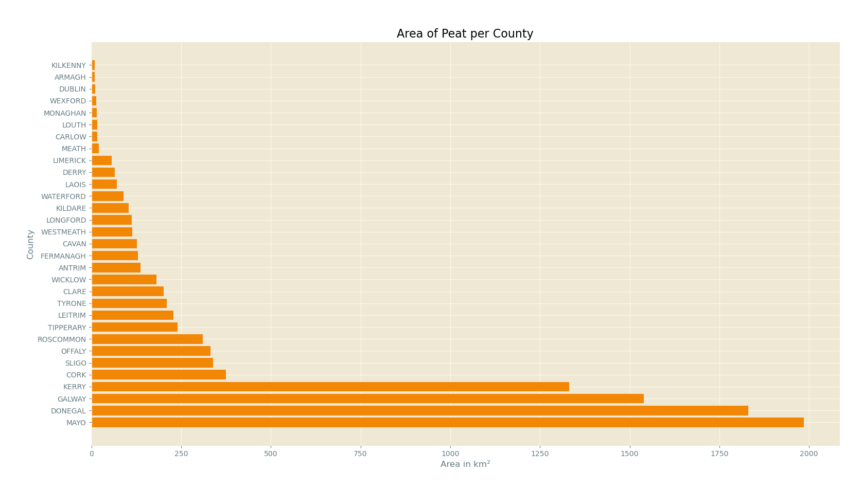
I was thinking since I posted this that there’s a bit of work involved to figure out the order of peat per county so I created a graph. For any GIS folks out there, I quickly unioned the county layer and the peat layer and then calculated the area in square kilometres for the peat and exported this as a CSV. I then used Matplotlib to create the below graph. If you’d like to know more about simple workflows like these just reach out to me on Twitter (@pearoid).